Traffic Calming
Roadway Design to Reduce Traffic Speeds and Volumes
~~~~~~~~~~~~~~
Victoria Transport Policy Institute
~~~~~~~~~~~~~~~~~~~~
Updated 18 July 2017
This chapter describes the concept of Traffic Calming, which refers to various roadway design features intended to reduce traffic speeds and volumes.
Description
Traffic Calming (also called Traffic Management) refers to various design features and strategies intended to reduce vehicle traffic speeds and volumes on a particular roadway. Table 1 describes some of these strategies. Traffic Calming projects can range from minor modifications of an individual street to comprehensive redesign of a road network. Home Zones refers to an area with extensive Traffic Calming. Traffic Calming is becoming increasingly accepted by transportation professionals and urban planners.
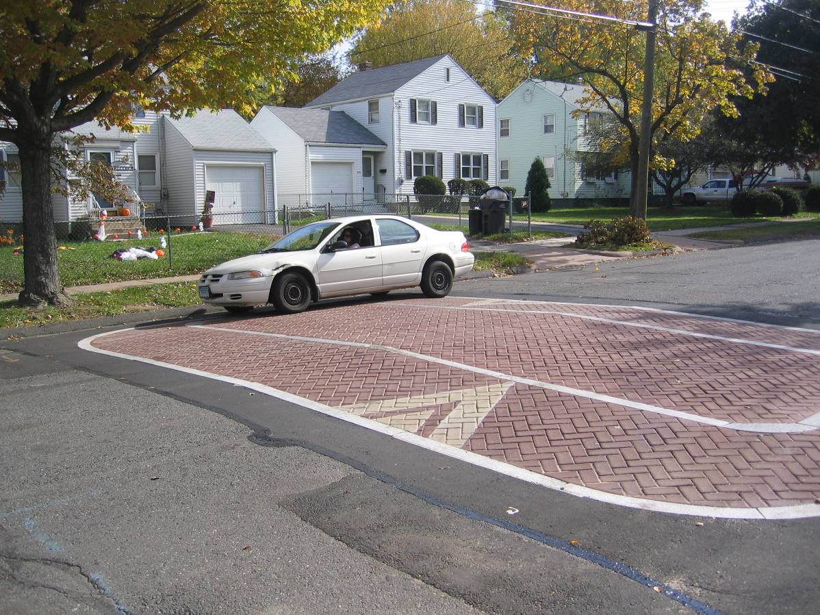
Table 1 Traffic Calming Strategies and Devices
|
Type |
Description |
|
Curb extensions “pinch points” |
Curb extensions, planters, or centerline traffic islands that narrow traffic lanes to control traffic and reduce pedestrian crossing distances. Also called “chokers.” |
|
Speed tables, raised crosswalks |
Ramped surface above roadway, 7-10 cm high, 3-6 m long. |
|
Mini-circles |
Small traffic circles at intersections. |
|
Median island |
Raised island in the road center (median) narrows lanes and provides pedestrian with a safe place to stop. |
|
Channelization islands |
A raised island that forces traffic in a particular direction, such as right-turn-only. |
|
Tighter corner radii |
The radius of street corners affects traffic turning speeds. A tighter radius forces drivers to reduce speed. It is particularly helpful for intersections with numerous pedestrians. |
|
Speed humps |
Curved 7-10 cm high, 3-4 m long hump. |
|
Speed lumps |
Two or more speed humps with gaps spaced to allow fire-rescue vehicles to pass without slowing. |
|
Rumble Strips |
Low bumps across road make noise when driven over. |
|
Chicanes |
Curb bulges or planters (usually 3) on alternating sides, forcing motorists to slow down. |
|
Roundabouts |
Medium to large circles at intersections (Kittelson, 2000). |
|
Pavement treatments |
Special pavement textures (cobbles, bricks, etc.) and markings to designate special areas. |
|
Bike lanes |
Marking bikelanes narrows traffic lanes. |
|
“Road diets” |
Reducing the number and width of traffic lanes, particularly on arterials. |
|
Horizontal shifts |
Lane centerline that curves or shifts. |
|
2-lanes narrow to 1-lane |
Curb bulge or center island narrows 2-lane road down to 1-lane, forcing traffic for each direction to take turns. |
|
Semi-diverters, partial closures |
Restrict entry/exit to/from neighborhood. Limit traffic flow at intersections. |
|
Street closures |
Closing off streets to through vehicle traffic at intersections or midblock |
|
“Neotraditional” street design |
Streets with narrower lanes, shorter blocks, T-intersections, and other design features to control traffic speed and volumes. |
|
Perceptual Design Features |
Patterns painted into road surfaces and other perceptual design features that encourage drivers to reduce their speeds. |
|
Street Trees |
Planting trees along a street to create a sense of enclosure and improve the pedestrian environment. |
|
Woonerf |
Streets with mixed vehicle and pedestrian traffic, where motorists are required to drive at very low speeds. |
|
Traffic speed reduction programs. Increased enforcement of speeding violations. |
|
|
Roadway striping |
Painting roadway markings that narrow traffic lanes and encourage lower traffic speeds. |
This table summarizes various Traffic Calming devices and strategies. For illustrations see www.pedbikeimages.org and DKS Associates, 2002.
Traffic Calming involves Context Sensitive Design practices, which means that roadway planners and engineers have flexible standards that can accommodate community values and balanced objectives. New Urbanism incorporates Traffic Calming features into the design of new developments and urban redevelopment. It can make urban streets safer and quieter. It can increase residential property values and local economic activity.
Figure 1 Speed Table
This illustrates a speed table used to limit traffic speeds on a residential street. (Photo curtsey of Urban Engineers)
Traffic Calming is one component of Area Traffic Management, which includes various strategies to control traffic volumes, control traffic speeds, manage transportation demand, educate and enforce traffic and pedestrian facility rules, improve the Streetscape design, and improve street environments (City of Ottawa 2004).
Traffic Calming changes Streetscape design to give greater emphasis to pedestrians, cyclists and residents. It applies Complete Streets principles, which recognize that roadways often serve diverse functions, and Reallocating Road Space to increase the portion of right-of-way devoted to bicycle lanes, sidewalks and greenspace. Some features, such as wider sidewalks and improved crosswalks, support Universal Design objectives (making transportation systems accommodate people with disabilities and other special needs). Street Reclaiming emphasizes action by neighborhood residents to change the way their streets are perceived and used to better accommodate nonmotorized activities.
Traffic calming sometimes involve changing traffic flow patterns, particularly converting one-way into two-way streets. Analysis by Gilderbloom and Riggs (2015) in several U.S. cities indicates that such conversions:
· Reduce traffic speeds.
· Increase walking and cycling activity.
· Significantly reduce traffic accidents.
· Reduce local crime rates.
· Increase local business activity.
· Increase property values and tax revenues.
Some research indicates that improved roadway landscaping and tree planting encourages walking and reduces accident rates (Naderi 2002; Dumbaugh 2005). Trees can be particularly beneficial in hot areas where they provide shade.
Most Traffic Calming projects are implemented on urban streets with low to moderate traffic volumes, but some strategies can reduce traffic speeds and improve pedestrian conditions on suburban streets, arterials and highways. Ponnaluri and Groce (2005) describe how speed humps are successfully implemented on moderate volume suburban roads, significantly reducing traffic speeds. Highway traffic speed control strategies can include visual messages (Fildes, et al., 1999; Meyer, 2001), gateways and roundabouts (Hass-Klau, et al, 1992; Kittelson, 2000), and special design treatments for highways that bisect towns (DEA & Associates, 1999).
Road Diets and Environmentally Adopted Through Roads refers to Traffic Calming applied to higher-volume arterials (CORDIS 1999; CTRE 2006; Rosales, 2007). Road diets typically involve converting four traffic lanes to three traffic lanes, with a center turn lane and bicycle lanes, and various pedestrian and aesthetic improvements. This is suitable for roads with up to 20,000 average motor vehicles per day. Stout, et al (2006) found that conversion of four-lane undivided roadways to three-lane cross-sections in typical Iowa towns reduced crash frequency by 25% and crash injuries by 34%. The table below summarizes the crash reduction benefits from some recent Road Diet projects. Highway Safety Information System (HSIS 2010) concludes that road diets typically reduce crash rates by 47% on major highways through small urban areas, by 19% on corridors in larger city suburban areas, and 29% overall.
Table 2 Road Diet Crash Reduction Impacts (Seattle DOT)
|
Roadway Location |
Date Change |
ADT Before |
ADT After |
Collision Reduction |
|
Greenwood Ave N, N 80th St to N 50th |
April 1995
|
11,872 |
12,427 |
24 to 10 (58%)
|
|
N 45th Street, Wallingford Area |
December 1972 |
19,421 |
20,274 |
45 to 23 (49%)
|
|
8th Ave NW, Ballard Area |
January 1994 |
10,549 |
11,858 |
18 to 7 (61%)
|
|
Martin Luther King Jr Way, North of I 90 |
January 1994 |
12,336 |
13,161 |
15 to 6 (60%) |
|
Dexter Ave N, Queen Ann Area |
June 1991
|
13,606 |
14,949 |
19 to 16 (59%)
|
|
24th Ave NW, NW 85th to NW 65th |
October 1995 |
9,727 |
9,754 |
14 to 10 (28%)
|
This table summaries the crash reduction effects of road diets on major arterials in Seattle, Washington. (ADT = Average Daily Traffic)
In previous decades many urban arterials were converted to one-way traffic to maximize traffic speeds and volumes. Some of these are now being converted back to two-way traffic in order to reduce traffic speeds and create more pedestrian-friendly streets. One study of such conversions in 22 U.S. cities found that almost all are considered successful (HMSBID 2000). Converting to two-way traffic improved business activity, increased investment on the street, improved traffic distribution (more choices on how to get around), helped create a more pedestrian-friendly environment, and produced a general feeling of improved “livability,” “quaintness” and “sense of community.” None reported significant negative effects or plans to convert back to one-way traffic.
Ivan, Garrick and Hanson (2009) observed traffic at about 300 locations in urban, suburban and rural areas across Connecticut, at locations without horizontal curves or traffic control devices. They found strong statistical relationships between traffic speeds and various roadway design factors. Higher average traffic speeds are associated with wide shoulders, large building setbacks and a residential location. Lower average traffic speeds are associated with on-street parking, sidewalks and a downtown or commercial location. These findings suggest that drivers slow down where the road feels “hemmed-in” or there is noticeable street activity, and they speed up where the road feels “wide open” or street activity is less noticeable.
Modern RoundaboutsA roundabout is an intersection built with a circular island around which traffic rotates in one direction. Many older roundabouts (which were also called traffic circles or rotaries) were built primarily as a location for a fountain or statue, with little regard to traffic principles. As a result, there has been considerable variation in design features and traffic regulation, causing confusion and accidents. For many years roundabouts were unpopular with the public and traffic professionals.
During the late Twentieth Century, traffic engineering organizations developed roundabout design standards and management practices to maximize traffic efficiency and safety. These are called “Modern Roundabouts.” They have the following features. · Yield at Entry. Traffic entering the roundabout yields the right-of-way to the circulating traffic. This prevents traffic from locking-up and allows free flow movement. · Deflection. The entry lane is designed with a small deflector island to reinforce the yielding process and slow traffic. · Limited size. Modern roundabouts usually have just one, and never more than two, rotating lanes.
In addition, there are mini-roundabouts, which are small traffic circles located within local intersections. They still require yield-at-entry but do not have a deflector island.
Research has shown that roundabouts can improve reduce vehicle stops and delays, reduce traffic speeds, and increase safety compared with other intersection designs. They are also used to provide a gateway or aesthetic feature. As a result, roundabouts are once again being promoted by traffic engineers and planners, and are an important Traffic Calming tool. They are increasingly common throughout the world. To maximize safety and establish consistency it is very important that all roundabouts be designed (and existing ones redesigned) to reflect Modern Roundabout principles.
Resources
Alaska Roundabouts (www.alaskaroundabouts.com/index.html) provides information on roundabout planning, including installations in Alaska.
Alex Ariniello, Are Roundabouts Good for Business?, TRB (http://pubsindex.trb.org/document/view/default.asp?lbid=775405),
Case study Bellingham, Washington (www.reidmiddleton.com/roundabout/rb_cs%20Cordata.htm)
FHWA, Roundabout Safety Comes to America, Federal Highway Administration (www.tfhrc.gov/pubrds/fall95/p95a41.htm), 1995. Article about the history of the modern roundabout, its characteristics and safety improvement record.
FHWA, Roundabouts: An Informational Guide, US Department of Transportation Federal Highway Administration (www.tfhrc.gov/safety/00068.htm)
George Jacquemart, Modern Roundabout Practice in the United States, NCHRP Synthesis 264, Transportation Research Board (www.trb.org), 1998.
Kittelson and Associates, Roundabouts: An Informational Guide, Turner Fairbank Highway Research Center, Federal Highway Administration, FHWA-RD-00-67 (www.tfhrc.gov/safety/00068.htm), June 2000.
NYDOT, Modern Roundabouts: Guidance for Design Engineers and Users, New York State Department of Transportation (www.dot.state.ny.us/roundabouts/howto.html). Detailed instruction for vehicle, pedestrian, and bicycle roundabout users with animated graphics.
Roundabouts and Traffic Circles, ABNA Engineering (www.abnaengineering.com/abna), 2000. Information on roundabouts by leading designers, Michael Wallwork and Richard M. Barnett Jr.
Roundabouts, an Informational Guide, Turner-Fairbanks Highway Research Center, Federal Highway Administration (www.tfhrc.gov/safety/00068.htm), 2000. Includes an outline of the book, a database of built and planned U.S. roundabouts, and an extensive bibliography of roundabout resources.
Roundabout USA (www.roundaboutsusa.com) is a comprehensive roundabout website with information for motorists, road designers, public officials with many photos of roundabouts in use throughout the country.
SIDRA Design (www.akcelik.com.au/SIDRA/roundabouts.htm), provides roundabout planning and design tools.
WSDOT, Roundabout Information and Benefits (www.wsdot.wa.gov/Projects/SR539/I5_Access/Tenmile_Border/Roundabouts.htm#13)
WSDOT, What is a Roundabout? Washington State Department of Transportation (www.wsdot.wa.gov/Projects/roundabouts), |
Traffic Calming measures must be carefully designed and managed to avoid degrading travel conditions for cyclists and visually impaired pedestrians. Unnecessary stop signs are a hindrance to cycling. On arterials, curb extensions and chicanes should not intrude into bicycle travel lanes (regardless of whether they are officially designated as bike lanes) and force cyclists to compete for road space with higher speed traffic. Street closures should allow access to nonmotorized modes. While small, slow speed, single lane traffic circles are easily negotiated by cyclists and people with visual disabilities, larger double-lane roundabouts with 20 km/h or higher traffic speeds can be difficult to negotiate.
How It Is Implemented
Traffic Calming implementation often begins with Complete Streets policies which recognize that roadways often serve diverse functions which must be considered and balanced in roadway design and management. Traffic Calming programs are usually implemented by local engineering departments. These programs involve educating planners and traffic engineers about Traffic Calming strategies, establishing policies and guidelines for implementing Traffic Calming projects, and developing funding sources. Specific Traffic Calming projects may be initiated by neighborhood requests, traffic safety programs, or as part of community redevelopment. Street Reclaiming is initiated and organized by neighborhood residents.
Travel Impacts
Traffic Calming reduces vehicle traffic speeds and sometimes volumes. The table below summarizes the traffic speed impacts of various Traffic Calming devices. Even where speed reductions are small, Traffic Calming tends to reduce the highest traffic speeds (i.e., the fastest 5-15% of vehicles), which provides greater safety and noise reduction benefits than indicated by average reductions. Traffic studies find that for every 1 meter increase in street width the 85th percentile vehicle traffic speed increases 1.6 kph, and the number of vehicles traveling 8 to 16 kph [5 or 10 mph] or more above the speed limit increases geometrically (“Appendix,” DKS Associates 2002). That study also found that as residential street traffic speeds increase, neighborhood livability ratings decline.
Table 3 Speed Impacts of Traffic Calming Measures (Ewing 1999)
|
|
Sample Size |
Avg. Speed Afterward (mph) |
Avg. Speed Change |
Avg. % Change |
|
12' Humps |
179 |
27.4 |
-7.6 |
-22 |
|
14' Humps |
15 |
25.6 |
-7.7 |
-23 |
|
22' Tables |
58 |
30.1 |
-6.6 |
-18 |
|
Longer Tables |
10 |
31.6 |
-3.2 |
-9 |
|
Raised Intersections |
3 |
34.3 |
-0.3 |
-1 |
|
Circles |
45 |
30.2 |
-3.9 |
-11 |
|
Narrowings |
7 |
32.3 |
-2.6 |
-4 |
|
One-Lane Slow Points |
5 |
28.6 |
-4.8 |
-14 |
|
Half Closures |
16 |
26.3 |
-6.0 |
-19 |
|
Diagonal Diverters |
7 |
27.9 |
-1.4 |
-0.5 |
From www.trafficcalming.org.
Traffic Calming tends to reduce total vehicle mileage in an area by reducing travel speeds and improving conditions for walking, cycling and transit use (Morrison, Thomson and Petticrew 2004). Residents in neighborhoods with suitable street environments tend to walk and bicycle more, ride transit more, and drive less than comparable households in other areas. One study found that residents in a pedestrian friendly community walked, bicycled, or rode transit for 49% of work trips and 15% of their non-work trips, 18- and 11-percentage points more than residents of a comparable automobile oriented community (Cervero and Radisch 1995). Another study found that walking is three times more common in a community with pedestrian friendly streets than in otherwise comparable communities that are less conducive to foot travel (Moudon, et al, 1996). Where Road Diets include the addition of cycling lanes, bicycle travel typically increases 20-30%. For more information see Land Use Impacts on Transport and Evaluating Nonmotorized Transport.
Various studies indicate an elasticity of vehicle travel with respect to travel time of –0.5 in the short run and –1.0 over the long run, meaning that a 20% reduction in average traffic speeds will reduce total vehicle travel by 10% during the first few years, and up to 20% over a longer time period (for more information see Transport Elasticities). Of course, most Traffic Calming projects only affect a small portion of total vehicle travel, so their impact on total vehicle travel is small. However, a comprehensive Traffic Calming program combined with other TDM strategies may have a significant effect on total vehicle travel.
Frank and Hawkins (2007) estimate that in a typical urban neighborhood, a change from a pure small-block grid to a modified grid (a Fused Grid, in which pedestrian and cycling travel is allowed, but automobile traffic is blocked at a significant portion of intersections) that increases the relative connectivity for pedestrians by 10% would typically increase home-based walking trips by 11.3%, increase the odds a person will meet the recommended level of physical activity through walking in their local travel by 26%, and decrease vehicles miles of local travel by 23%.
The following factors influence how much a Traffic Calming project affects travel:
· Magnitude of change. The more Traffic Calming reduces traffic speeds and improves walking and cycling conditions, the more it will affect total travel. Traffic Calming that significantly reduces a barrier to non-motorized travel (for example, by making it easier to walk across an arterial from one major activity center to another or creating a pleasant bicycle travel corridor where none otherwise exists) may have significant travel impacts in an area.
· Walking and Cycling Demand. A Traffic Calming project will have the most travel impacts if implemented near major pedestrian and cycling generators: residential neighborhoods, commercial centers, schools, and recreation centers.
· Integration with other improvements. Traffic Calming complements other demand management efforts. Traffic Calming can increase the effectiveness of Pedestrian and Cycling Improvements, Parking Management, Transit Improvements, New Urbanism and many other TDM strategies.
· Land use effects. Traffic Calming supports Clustered, mixed-use, infill, pedestrian-oriented land use development that further reduce automobile use and automobile dependency over the long run.
Table 4 Travel Impact Summary
|
Objective |
Rating |
Comments |
|
Reduces total traffic. |
2 |
Discourages automobile traffic and increases travel alternatives. |
|
Reduces peak period traffic. |
0 |
|
|
Shifts peak to off-peak periods. |
0 |
|
|
Shifts automobile travel to alternative modes. |
2 |
Improves walking and cycling conditions and discourages automobile use. |
|
Improves access, reduces the need for travel. |
1 |
Encourages higher-density, mixed land use. |
|
Increased ridesharing. |
0 |
|
|
Increased public transit. |
1 |
Improves access to transit. |
|
Increased cycling. |
2 |
Improves cycling conditions. |
|
Increased walking. |
3 |
Improves walking conditions. |
|
Increased Telework. |
0 |
|
|
Reduced freight traffic. |
0 |
|
Rating from 3 (very beneficial) to –3 (very harmful). A 0 indicates no impact or mixed impacts.
Benefits And Costs
Traffic Calming benefits and costs are summarized in the table below.
Table 5 Traffic Calming Impacts (Litman, 1999)
|
|
Description |
|
Benefits |
|
|
Increased Road Safety. |
Reduced traffic accident frequency and severity, particularly for crashes involving pedestrians and cyclists. |
|
Increased comfort and mobility for non-motorized travel. |
Increased comfort and mobility for pedestrians and cyclists. |
|
Reduced automobile impacts. |
Increased non-motorized travel substitutes for automobile trips, reducing congestion, expenses and pollution. |
|
Increased Community Livability |
Reduced noise and air pollution, and improved aesthetics. |
|
Increased neighborhood interaction. |
More hospitable streets encourage street activities and community interaction. |
|
Increased property values. |
Reduced traffic speed and volumes increase residential property values. |
|
More opportunities for walking and other physical activity. |
|
|
Costs |
|
|
Project expenses. |
Financial costs associated with implementing and maintaining Traffic Calming facilities. |
|
Liability claims |
Increased liability claims caused by Traffic Calming. |
|
Vehicle delay. |
Reduced traffic speeds. Motorists either increase their travel time or reduce travel distance. |
|
Traffic spillover on other streets. |
Traffic Calming on one street can shift traffic to other streets. |
|
Problems for emergency and service vehicles. |
Delay to fire trucks, and problems for buses, garbage trucks and snow plows. |
|
Increased drivers’ effort and frustration. |
Increased effort required for driving on traffic calmed roads and the resulting frustration. |
|
Problems for bicyclists and visually impaired pedestrians. |
Some Traffic Calming strategies cause problems to bicyclists or visually impaired pedestrians. |
Kahn and Kahn Goedecke (2011) compare various traffic calming devices and highlight the relative advantages of road striping as a particularly inexpensive way to reduce traffic speeds on some roadways, as summarized in Table 6.
Table 6 Comparison of Traffic Calming Devices (Kahn and Kahn Goedecke 2011)
|
Traffic Calming Technique |
Pros |
Cons |
Speed Reduction |
Typical Cost |
|
Speed hump |
• Effectively reduces speed by approximately 8 mph. • Can cause some diversion of excess traffic volumes. |
• Not accepted by many local jurisdictions and emergency service agencies. • Improper driving can cause vehicle damage and can cause vehicles to go out of control. • Moderate cost considerations. • Can impact bicycles/motorcycles. • Difficult to remove. |
8 mph |
$1,500 to $3,000 |
|
Speed cushion |
• Effective in reducing speeds up to 5 miles per hour. • More acceptable to public agencies /emergency service agencies, because can slow normal size vehicles but allows larger emergency vehicles to pass without speed reductions. |
• Some agencies and emergency service agencies do not support these devices. • Cost for construction is moderate. • Difficult to remove. • May impact bicycles/motorcycles. |
5 mph |
$2,500 to $3,500 |
|
Chokers and chicanes |
• Effectively reduces traffic speeds approximately 3 miles per hour. • Can reduce roadway width to reduce walking distance for pedestrian (which is a safety benefit). • Can be enhanced with landscaping to improve aesthetics. |
• Expensive to implement. • Can cause drainage issues. • Difficult to remove in the future if not effective. • Some loss of parking. • Can impact bicycles. |
3– 6 mph |
$7,000– $15,000 per pair
|
|
Medians |
• Can reduce speeds to some degree. • Can provide aesthetic benefits to the community. |
• Costly to implement. • Difficult to remove if not successful. • Can cause additional maintenance costs. • Water overall on pavement. • May lose parking. |
2-3 mph |
$5,000– $15,000 |
|
Pavement texture |
• Can cause minor reduction in speed. • Can be aesthetically pleasing. • Can be tied into crosswalks or intersections to define channelized areas for pedestrians. |
• Costly to implement. • Difficult to remove. • Can effect some types of pedestrians crossing the street. • Can cause noise impacts. |
Limited data |
$5–$16 per sq. ft. |
|
Mini traffic circles |
• Minor reduction in speed. • Improves aesthetics. • Slows traffic through the intersection. |
• Costly to implement. • Can confuse drivers regarding which way to travel through an intersection. • May affect bicycles and pedestrians. • Can impact left turns for large vehicles. • Can slow emergency service vehicles. |
4-6 mph |
$10,000– $60,000 |
|
Traffic calming striping |
• Effective in reducing speeds from 1 to 7+ miles per hour. • Accepted by many public agencies and emergency service agencies because they are standard traffic control. • Easy to change if required in the future. • Less costly option to install • Installation can be implemented quickly. • Can be removed more easily than other options (sand blast). |
• Some limitations in speed reduction. • Less effective when speeds are already low. |
1-7+ mph |
$500– $1,000 per 500-feet |
Safety Benefits
Traffic Calming can significantly reduce crash risk, particularly for pedestrians and cyclists (Safety Evaluation). Lower vehicle speeds reduce the likelihood of crashes and the degree of injury that results (Leaf and Preusser 1998; NCCHPP 2011). Fatality risk increases with vehicle speed to the fourth power; a 1% reduction in the speed of a vehicle involved in a collision provides a 2% reduction in the risk of injuries and a 4% reduction in the risk of fatalities (Stuster and Coffman 1998). The severity of pedestrian injuries from vehicle crashes increase with the square of speed (ITE 1997, p. 18). The probability of a pedestrian being killed in a crash is 3.5% if the vehicle is traveling at 15 mph, 37% at 31 mph and 83% at 44 mph (Limpert 1994, p. 663).
Field studies show significant safety benefits from Traffic Calming, as indicated in the table below. A detailed survey (meta-analysis) of 33 studies by Elvik (2001) found that area-wide traffic calming programs reduce injury accidents by about 15%, with the largest reduction is on residential streets (25%), and somewhat smaller reductions on main roads (10%).
Table 7 Safety Impacts of Traffic Calming Measures, U.S. Experience
|
|
Number of Observations |
Average Number of Collisions |
% Change in Collisions |
|
|
|
|
Before |
After |
|
|
12' Humps |
49 |
2.7 |
2.4 |
-11% |
|
14' Humps |
5 |
4.4 |
2.6 |
-41% |
|
22' Tables |
8 |
6.7 |
3.7 |
-45% |
|
Circles |
130 |
2.2 |
0.6 |
-73% |
|
All Measures – |
192 |
2.6 |
1.3 |
-50% |
(Ewing 1999; www.trafficcalming.org)
A study by the Insurance Institute for Highway Safety found that traffic roundabouts which replace conventional intersections reduce total crashes 39% and injury crashes by 76%, and estimates that fatal and incapacitating injury crashes could be reduced about 90% (Persaud 2000). These results are consistent with other international studies.
Narrower roads with fewer traffic lanes are associated with significantly lower crash risk to pedestrians than wider roads (Zegeer, et al. 2002; AARP 2009). Landscaping in the center median of urban arterials was found to significantly reduce crash rates (Mok, Landphair and Naderi 2003). The additional risk to pedestrians associated with multi-lane roads can be reduced with design features such as raised center meridians (which give pedestrians a safe refuge when they are halfway across the road) and Speed Reduction strategies (Gårder 2004). Converting four-lane urban arterials to two lanes plus a center turn lane tends to reduce collisions about 1/3, improves pedestrian travel and causes only minor reductions in traffic volumes (Welsh 2001).
Wei and Lovegrove (2010) evaluated the road safety of five neighbourhood patterns – grid, culs-de-sac, and Dutch Sustainable Road Safety (SRS, or limited access), 3-way offset, and fused grid networks. Analysis using standard transportation planning methodology revealed that all can maintain similar levels of mobility and accessibility. Analysis using standard road safety analysis methodology further revealed that the 3-way offset, and fused grid patterns significantly improve road safety, by as much as 60% compared to prevalent patterns (i.e. grid and culs-de-sac). These results do not account for the additional safety benefits that result from roadway designs that, by improving non-motorized travel conditions tend to shift travel from auto to non-auto modes. As a result, these can be considered lower-bound estimates of safety benefits.
Annual crash rates per lane-mile tend to increase with lane width, and are highest on wider, lower volume, straight streets that have the highest speeds (Swift, Painter and Goldstein 2006; Zegeer, et al. 1994; AARP 2009). 24-foot streets appear to have the lowest accident rates. This suggests that narrower street designs and traffic calming can increase road safety.
Traffic Calming provides greater overall safety benefits than the cul-de-sac street designs often used to increase safety. Lucy and Phillips (2006) find that crash rates increase with the number of cul-de-sacs in an area, because any increase in safety on cul-de-sacs is offset by the additional vehicle-mileage induced by less connected street systems.
Health Benefits
Traffic Calming tends to increase walking and cycling activity in an area, which tends to improve physical Health (Morrison, Thomson and Petticrew 2004; NCCHPP 2011). Inadequate physical activity is a major contributor to cardiovascular disease, diabetes, hypertension, obesity, osteoporosis and some cancers.
Economic Development Benefits
Traffic Calming can help improve retail environments and support local Economic Development. In a survey of business owners in an urban retail district, Drennen (2003) found that 65% consider a local Traffic Calming program to provide overall economic benefits, compared with 4% that consider it overall negative, and 65% support further traffic calming projects in their area. These benefits can be particularly important in tourist-oriented business districts, and as part of community revitalization. Drennen also argues that Traffic Calming can provide economic benefits by increasing use of alternative modes and reducing automobile expenditures, giving consumers more money to spend on locally produced goods. Drennen discusses the following potential economic impacts of traffic calming.
- Economic Revitalization and Property Values. Traffic calming can increase residential and commercial property values, which attracts wealthier residents to the area (gentrification) and can increase retail sales and bring economic revitalization to a commercial corridor.
- Attractiveness and Safety. Traffic calming creates more attractive environments, reduces auto speed, and increases safety for pedestrians, bicyclists, drivers, and other users of the street, which is good for business.
- Sales and Attracting Customers. Traffic calming encourages local residents to buy in their own neighborhoods, and also attracts customers from a wider area due to reduced travel time, hassle, and cost. Traffic calming can also help people live less car-dependent lifestyles, which will increase the amount of discretionary income they can spend on things other than transportation.
- Parking. Most businesses are concerned about the quality and quantity of customer parking and access for delivery trucks. However, too large a supply of subsidized, on-street parking can harm businesses.
- Impact on Employees. Poor bicycle, pedestrian, and transit conditions can harm businesses by losing worker productivity and time to gridlock, and by impairing employee recruitment. Conversely, improved transportation facilities can provide more convenience for employees.
- Construction and Costs. Traffic calming projects often require only minimal “down time” for construction, and most do not require any investment from business owners.
Property Value Impacts
Traffic Calming can improve Community Livability, which tends to increase property values. Hughes and Sirmans (1992) find that residential properties have higher values if located on a street with lower traffic volumes and speeds. Similar effects can occur on commercial streets. A study that compared property values in a Grand Rapids, Michigan residential neighborhood after a traffic management program was implemented found that traffic volume reductions of a few hundred motor vehicles per day increased adjacent residential property values by 5-25% (Bagby, 1980). Another study found that homes in New Urbanist communities sold for $20,189 more on average than comparable homes in conventional communities, an 11% increase in value, which is probably partly due to Traffic Calming that is integrated in New Urbanist communities (Eppli and Tu 2000). In several case studies, reducing traffic speeds and making streets more pedestrian-friendly significantly increased retail sales and property values (LGC 2001).
Costs
Costs include program expenses and reduced motor vehicle traffic speeds. The table below provides generic cost estimates for typical Traffic Calming measures. Coulter Transportation Consulting (2004) identifies various potential problems associated with traffic calming, including uncertainty about impacts and installation costs.
Table 8 Typical Costs of Traffic Calming Measures (Seattle Engineering Dept., 1996; Zegeer, et al 2002; Krizek, et al. 2006)
|
Measure |
Typical Costs (U.S. Dollars) |
|
Asphalt walkway |
$30-40 per linear foot for 5-foot wide walkway. |
|
Curb ramps |
$1,500 per ramp. |
|
Bike lanes |
$10,000-50,000 per mile to modify existing roadway (no new construction). |
|
Chokers |
$7,000 for landscaped choker on asphalt street, $13,000 on concrete street. |
|
Curb bulbs |
$10,000-20,000 per bulb. |
|
Traffic circles |
$4,000 for landscaped circle on asphalt street, $6,000 on concrete street. |
|
Chicanes |
$8,000 for landscaped chicanes on asphalt streets, $14,000 on concrete streets. |
|
Street closures |
$6,500 for landscaped partial closure, $30,000-100,000 for full closure. |
|
Marked crosswalk |
$100-300 for painted crosswalks, $3,000 for patterned concrete. |
|
Pedestrian refuge island |
$6,000-9,000, depending on materials and conditions. |
|
Center medians |
$15,000-20,000 per 100 feet. |
|
Traffic signals |
$15,000-60,000 for a new signal. |
|
Raised intersection |
$70,000+ per intersection |
|
Traffic signs |
$75-100 per sign. |
|
Speed humps |
$2,000 per hump |
Traffic Calming critics raise the following concerns (Seconds Count 2000):
· Delay to emergency vehicles.
· Civil rights violations (if traffic restrictions limit access to some neighborhoods).
· Increased air pollution (from speed humps).
· Discomfort to people with disabilities (from speed humps).
· Problems for cyclists.
· Liability and lawsuits.
· Neighborhood conflict.
In field tests Atkins and Coleman (1997) found that speed humps and traffic circles cause virtually no delay to small emergency vehicles, but add several seconds delay per device for large fire trucks. The Local Government Commission has produced a fact sheet that describes how emergency vehicle access needs can be addressed in narrow street design (LGC 2007). The per capita risk of death from residential fires is far lower than from pedestrian crashes, which implies that Traffic Calming can provide net safety benefits, although exact impacts vary depending on circumstances. Burden (2000a) describes how to incorporate emergency response concerns when planning traffic calming projects.
Speed lumps are two or more speed humps with gaps precisely spaced to allow the wheel tracks of fire-rescue vehicles to pass with minimal speed reductions. Traffic Calming devices such as curb extensions can benefit emergency response by removing the possibility of vehicles parking near a corner, which assures unrestricted entry at all times, and facilitates access to adjacent fire hydrants.
Impacts on pollution emissions are difficult to predict, particularly if Traffic Calming reduces overall traffic volumes. Traffic Calming strategies that result in slower, smooth traffic flow (roundabouts, neckdowns, chicanes) are likely to minimize pollution emissions compared with strategies that require frequent stops, such as stop signs and speed humps, and some traffic modeling indicates overall emission reductions (Smidfelt and Rosqvist 2007). Some Traffic Calming measures can create problems for cyclists and visually impaired pedestrians, although such problems can be avoided if they are considered in project planning and the design of Traffic Calming devices.
Ewing (2003) investigates legal liability and lawsuits over traffic calming. He found very few successful claims or suits in the U.S., except where facilities are improperly installed or maintained and concludes that, “A traffic calming following rational procedures is unlikely to succumb to a legal challenge.”
Table 9 Benefit Summary
|
Objective |
Rating |
Comments |
|
Congestion Reduction |
-1 |
Reduces roadway speeds and may reduce traffic capacity. |
|
Road & Parking Savings |
0 |
No significant impact. May increase some maintenance costs but reduces others. |
|
Consumer Savings |
1 |
Allows more walking and cycling, and can increase residential property values. |
|
Transport Choice |
3 |
Allows more walking and cycling. |
|
Road Safety |
3 |
Significant safety benefits. |
|
Environmental Protection |
2 |
Reduces traffic noise and total vehicle travel. |
|
Efficient Land Use |
2 |
Supports higher-density, mixed use, pedestrian-oriented development. |
|
Community Livability |
3 |
Reduces traffic impacts on neighborhoods. |
Rating from 3 (very beneficial) to –3 (very harmful). A 0 indicates no impact or mixed impacts.
Equity Impacts
Traffic Calming can disadvantage some motorists (particularly those who want to speed), and benefits non-drivers most. Some projects benefit residents of one street or area at the expense of others. Traffic Calming can increase horizontal equity by helping to create a more balanced transportation system that increases travel choices for non-drivers and reduces the external costs (crash risk and noise) of motor vehicle travel (Bellefleur 2013). Traffic Calming tends to benefit people who are economically, physically and socially disadvantaged, since they often walk and cycle, are highly vulnerable to vehicle crash injuries, and are more likely to live in older urban neighborhoods (AARP 2009). Grayling, et al. (2001) show that Traffic Calming is particularly beneficial to economically and socially disadvantaged communities.
Table 10 Equity Summary
|
Criteria |
Rating |
Comments |
|
Treats everybody equally. |
1 |
Usually. In some cases favors residents of one street over others. |
|
Individuals bear the costs they impose. |
2 |
Reduces externalities (crash risk and noise imposed by motorized traffic on pedestrians). |
|
Progressive with respect to income. |
2 |
Significantly benefits nondrivers, who tend to be lower income. |
|
Benefits transportation disadvantaged. |
3 |
Significantly benefits nondrivers. |
|
Improves basic mobility. |
1 |
Improves nonmotorized travel, but can delay emergency vehicles. |
Rating from 3 (very beneficial) to –3 (very harmful). A 0 indicates no impact or mixed impacts.
Applications
Traffic Calming is applied most often in urban residential and commercial areas, where there is potential for increased walking and cycling. Some Traffic Calming strategies can be applied on arterials and highways.
Table 11 Application Summary
|
Geographic |
Rating |
Organization |
Rating |
|
Large urban region. |
1 |
Federal government. |
0 |
|
High-density, urban. |
3 |
State/provincial government. |
2 |
|
Medium-density, urban/suburban. |
3 |
Regional government. |
3 |
|
Town. |
3 |
Municipal/local government. |
3 |
|
Low-density, rural. |
1 |
Business Associations/TMA. |
2 |
|
Commercial center. |
3 |
Individual business. |
1 |
|
Residential neighborhood. |
3 |
Developer. |
2 |
|
Resort/recreation area. |
3 |
Neighborhood association. |
3 |
|
|
|
Campus. |
3 |
Ratings range from 0 (not appropriate) to 3 (very appropriate).
Categories
Improved Transport Choice and Incentive to Reduce Driving
Relationships With Other TDM Strategies
Traffic Calming supports and is supported by Vehicle Restrictions, Speed Reductions, Context Sensitive Design, Nonmotorized Transport Improvements, Universal Design, Smart Growth, New Urbanism, Clustering, Streetscaping and Campus Transportation Management. Since most transit trips involve walking links, Traffic Calming is a Transit Improvement that supports Transit Oriented Development. Street Reclaiming and Road Space Reallocation are other traffic impact reduction strategies.
Stakeholders
Traffic Calming is usually implemented by local governments, often with the involvement of organizations representing residents and local businesses. Traffic Calming projects are often initiated by neighborhood groups concerned about pedestrian safety and traffic impacts.
Barriers To Implementation
Barriers include resistance by some transportation professionals (those who emphasize vehicle traffic flow over other street design objectives), and financial costs for implementing Traffic Calming projects. There is sometimes opposition from residents to Traffic Calming, although this usually relates to specific Traffic Calming devices (such as speed humps) rather than the overall concept of Traffic Calming. Opposition often declines significantly within a few months after Traffic Calming is implemented. One survey found that most drivers (55%) oppose traffic roundabouts before construction, with most (41%) strongly opposed, but this declined to 28% opposed and 15% strongly opposed after construction (Retting, Luttrell and Russell, 2002).
Best Practices
Traffic Calming design involves both science and art. The following are guidelines for Traffic Calming best practices:
1. Traffic Calming planning should include adequate public involvement.
2. Involve experts familiar with the latest Traffic Calming resources and design standards.
3. Apply Complete Streets policies which recognize that roadways often serve diverse functions including through travel, recreational walking, socializing, vending, and nearby living, which must be considered and balanced in roadway design and management.
4. Planners should consider a variety of Traffic Calming devices, rather than relying on a single type, such as speed humps or rumble strips.
5. Traffic Calming projects should support multiple objectives, including enhanced street aesthetics, improved walking and cycling conditions, as well as controlling traffic speeds.
6. Stop signs should not be used as Traffic Calming devices.
7. Devices that are new to an area should be implemented on a trial basis with adequate signing. For example, the first traffic circles in an area should have signs showing the path vehicles should follow. After a few years such signs become unnecessary.
Below are planning and design principles to help build healthy communities and streets, based on Dan Burden’s 2001 Distinguished Lecture at the Transportation Research Board Annual Meeting.
· Build for everyone. Streets have multiple uses that must be balanced.
· Create many linkages. Develop a well-connected street network that offers multiple routes and modes to destinations. Add special walking and cycling linkages where possible (for example, mid-block walkways and paths that connect deadend streets).
· Make sidewalks that are comfortable, and streets that are easy to cross.
· Build narrow streets and compact intersections. This makes it easier for pedestrians to cross.
· Keep urban traffic dispersed, low speed and moving.
· Build green streets that include trees and boulevards.
· Provide ADA access (Universal Design).
· Build public space. Recognize that streets are primary component of the public realm, where people can interact and build community.
· Build with proper size and scale. Scale for people, not just for cars.
· Encourage diversity. Provide mixed uses and mixed incomes within a community. Create a maximum number of activities within walking distance of each neighborhood.
|
We don’t get much traffic by our house. We live on a one-way, dead-end street. |
Case Studies and Examples
West Palm Beach (Stillings and Lockwood, 2001)
The city of West Palm Beach, Florida (population 80,000) has developed “second generation traffic calming” which means that traffic calming design features are normally implemented when a street is built or reconstructed (whether for utility work or otherwise), rather than considering traffic calming a special program or treatment. This approach is found to be most cost effective and equitable, and has greatly improved the community’s walkability. The city’s successes include:
· Clematis Street was a typical one-way urban arterial, with three traffic lanes and two parking lanes. It was a run-down area with 80% vacant properties. The city implemented a streetscaping plan with traffic calming and pedestrian improvements that included converting it to two-way traffic, narrowings, a raised intersection, lateral shifts, and removal of turn lanes and traffic signals. Since this work was completed the street has become a major activity center with a wide variety of thriving businesses and a 10-fold increase in property values.
· CityPlace is a new 77-acre, $400 million, mixed-use development near Clematis Street that is being constructed with traffic calming and New Urbanist features, including bulbouts, narrow and raised intersections, on-street parking, wide sidewalks, and buildings that have ground-level shops with offices and residences above, to create a pedestrian-oriented district.
· Old Northwood and Northboro Park are residential neighborhoods that have had extensive traffic calming to reduce cut-through traffic. As a result they have changed from being depressed, undesirable areas with serious crime problems to attractive neighborhoods popular with young families.
Health Benefits of Traffic Calming (http://injuryprevention.bmj.com/content/15/6/369.full.html)
Jacobsen, Racioppi and Rutter (2009) examine the impact of vehicle traffic on levels of walking and bicycling based on a comprehensive review of medical, public health, city planning, public administration and traffic engineering technical literature. The analysis indicates that real and perceived danger and discomfort imposed by traffic discourages walking and bicycling. Although it can be difficult to measure these effects, observed behaviour provides good evidence for these effects, with the strongest association being an inverse correlation between volumes and speeds of traffic and levels of walking and cycling. They conclude that interventions to reduce traffic speed and volume are likely to improve public health by increasing walking and bicycling activity.
Survey of Traffic Calming Implementation
A survey of 21 transportation agencies with significant traffic calming programs indicates that between 1997 and 2004 such programs expanded and public acceptance increased.
Table 12 Summary of Traffic Calming Practices (Ewing, Brown and Hoyt 2005)
|
Issue |
Findings |
|
Program budget |
Program capital budgets range form $30,000 to $600,000 per year. Of agencies surveyed approximately 50% either are unfounded or rely exclusively on resident funding. |
|
Resident funding |
Approximately half of the agencies rely on residents to fund some or all of the construction costs. |
|
Installed with new development |
Approximately half of the agencies incorporate traffic calming devices into new developments. Tow agencies have adopted guidelines for traffic calming in new developments. |
|
Public involvement |
All agencies surveyed rely on resident or neighborhood associations to submit petitions requesting treatment. Some agencies also would consider staff or commission appointed petitions. More than half involve the public through a committee or neighborhood association to help develop a plan. |
|
Fire department involvement |
All of the agencies surveyed involve the fire department in the design of the available devices and/or during the planning process. Some agencies give veto power to the fire department. Some agencies have designated primary emergency response routes that preclude certain types of treatments. |
|
Treatment of arterials |
Six of the surveyed agencies consider treating arterials, with a limited toolbox of eligible devices. None of these agencies allow use of vertical devices on arterials. |
|
Priorities |
In total, 75% of the agencies rely on some form of a quantifiable priority ranking system. Some agencies treat problems in the order petitions are received; tow agencies rely on resident funding and, therefore, no prioritization system is needed. |
|
Device eligibility |
A majority of agencies use warrants or guidelines to determine device eligibility; the remaining eight agencies rely on a staff determination. |
|
Toolbox |
All but two of the agencies have comprehensive toolboxes (menu of calming devices that may be used). Almost half of the agencies reject STOP signs as traffic calming devices. |
This table summarizes major findings from a survey of 21 transportation planning agencies that have traffic calming implementation programs.
Seattle Traffic Calming (www.usroads.com/journals/rmej/9801/rm980102.htm)
The City of Seattle, Washington has implemented more than 700 traffic circles on residential streets and adds dozens more each year (Mundell, 1998). It has a standard process for residents to request Traffic Calming, and various funding sources (Seattle, 1996). The response has been positive: there are hundreds of requests each year for more Traffic Calming projects, and although devices can be removed if residents are unhappy with the final result, this has only happened once.
Lane Width Standards
The city of Tucson has established the following roadway lane widths, which are considered idea for mixed traffic.
- The standard width for a travel lane is 12 feet, which may be reduced to 11 feet if needed to accommodate a bike lane. For roadways with a posted speed limit no greater than 40 mph traffic lanes with no opposing traffic in an adjacent lane may be reduced to approximately 10 feet, based on engineering judgment.
- The standard width for turn lanes is typically 12 feet, however, turn lanes may be reduced to 10 feet where the cross section width is limited. Turn lane widths may be further reduced to 9 feet, based on engineering judgment.
- The standard width for a bike lane is 5 feet, excluding the gutter pan. For major streets with limited cross-section width the bike lane may be reduced to approximately 4 feet in width, including the gutter pan. Higher roadway speeds (more than 40 mph) and absence of a gutter pan would indicate the need for a wider bike lane where the width is available.
- When placed to the left of a Right Turn Only lane, the width of a bike lane should be a minimum of 5 feet. For intersections with limited cross section width, such a bike lane may be reduced to 4 feet, or even to 3 feet for locations of very limited pavement width, based on engineering judgment.
|
|
Bike Lane |
Motor Vehicle Travel Lane |
|
Standard Width |
5 feet |
12 Feet |
|
Reduced Width |
4 Feet |
11 Feet |
As much as possible, bikeways should be designed to cross railroad tracks at or near right angles. Where this is not feasible, consideration should be given to installing appropriate warning signs. Bike lanes may be widened at these locations to allow cyclists to cross tracks closer to a right angle while staying within the lane, as described by the AASHTO Guide for the Development of Bicycle Facilities.
Community Planning Charrettes (www.walkable.org)
The organization Walkable Communities has participated in dozens of community planning charrettes, in which residents and experts work together to design and organize roadway improvements, many of which include Traffic Calming.
Home Zones (www.homezonenews.org.uk)
The British government has developed policies to allow highway authorities to designate streets as “home zones,” residential streets with limited traffic speeds. Within these zones, street activity, including play, will be lawful. Design speeds will be less than 20mph - probably 10mph. Signs will be posted at the area edges to indicate their special status. Designs will include shared surfaces (no curbs), landscaping and play equipment. The federal government will distribute funding to local agencies for planning and implementation.
Economic Development Benefits
Edgewater Drive in Orlando, Florida involved traffic calming, speed reduction and the conversion of a 4-lane undivided roadway into a 3-lane road with bike lanes and on-street parking. While the neighborhood itself is very walkable, as a 4-lane “Main Street” Edgewater Drive was not. The road runs through a large neighborhood of about 10,000 people on a highly connected grid network. Edgewater Drive serves as the commercial main street for the community, with a grocery store, post office, high school, several pharmacies, high-end as well as moderate restaurants, and a neighborhood size hardware store. Most of the buildings are oriented towards the sidewalk. Results of this conversion can be found at: www.cityoforlando.net/planning/Transportation/documents/Edgewater.pdf. Since the project was implemented many new businesses have opened on the street. City staff believe that this resulted, in part, from the more pedestrian-friendly conditions.
Pedestrian Safety Operations Proving Effective (www.odot.state.or.us/comm/news/2002071801.htm)
Oregon cities have been able to reduce pedestrian crashes by increasing pedestrian law enforcement. Under the Pedestrian Safety Operations (PSE) program, a decoy police officer attempts to cross in a crosswalk, with a video camera recording the event. If passing motorists fail to stop and yield as required by law, they are issued either a warning or a citation. Three years since the program was established crosswalk pedestrian injuries declined by 16% (from 348 to 293) and fatalities declined 19% (from 16 to 13).
Some people have criticized these as “sting” operations, but the program is not designed to surprise or entrap motorists. The purpose is to raise awareness, not write citations. Advance warning is provided through media coverage and on-site signs. Police support the program as an effective crash prevention strategy, with 31 police departments and sheriff’s offices participating in 2002.
“We are grateful to all participating law enforcement agencies. They’ve done a great job,” said Rick Waring, Pedestrian Safety Program coordinator for ODOT. “Pedestrian safety is a serious issue in every community—people have trouble getting across their streets and they are delighted someone is doing something about it. Community response from citizens and public officials has been overwhelmingly positive,” said Waring.
ODOT’s pedestrian safety program also has provided specialized training for 71 police agencies and 108 officers and deputies. The goal is to teach officers to set up the operation so it is fair to motorists, yet has the desired effect of raising awareness and improving safety for pedestrians. For more information, contact the Oregon Department of Transportation Bicycle and Pedestrian Safety Program, (www.odot.state.or.us).
Driving the argument home (BBC News )
By Sean Coughlan, BBC News (http://news.bbc.co.uk/1/hi/uk/4459056.stm), 22 November 2005.
A campaign is under way to lower speed limits to 20mph in urban areas, but what's going to make drivers slow down? A bossy road sign, a hump in the road or a three-piece suite parked in the road?
There's no reason that traffic calming should be boring or without a sense of humour, says children's author and traffic campaigner, Ted Dewan. And using his Oxford residential street as a test laboratory, Mr. Dewan has been working on more creative ways to reduce traffic speed. “People are too used to being scolded by warning signs telling them about lethal speed and driving. It's like 'tell me something new'. But they're not used to having their wit engaged,” he says.
So in a spirit that combines a sense of entertainment with a serious intent, he has come up with the idea of “folk traffic calming.” This is where art installations meet road safety, a kind of sleeping policeman that's been influenced by Damien Hirst.
We live here
These type of “DIY traffic-calming happenings” are described by their creator as “roadwitches” and have included an 11-feet high rabbit, a big bed (for a sleeping policeman), a Casualty-style fake crash scene for Halloween and the setting up of a living room in the middle of the road. “There's an element of fun and mischief, but underneath is the ambition to encourage people to re-examine how roads are used,” says Mr. Dewan. “With the living room, it was the most direct way of saying ‘We live here. This is our living space.’”
And he says that residents really enjoyed the strangeness of being able to relax outside in their own street, rather than feel it was a place only belonging to the cars that race up and down it. Residents had forgotten what it was like to have a street without the usual high-volume and low-courtesy of passing traffic.
Initially the street was legally closed, to allow the setting up of this outdoor living room, including such middle-England touches as a standard lamp. It was then re-arranged to allow traffic to pass through, but Mr. Dewan says the reactions of motorists showed how motorists expect nothing to stand in their way.
Psychotic
“A driver of a 4x4 didn't so much disapprove - he was too crazed and violent for that. He seemed to be made psychotic by the idea that roads could exist for anything other than him to drive on,” he says. This motorist deliberately drove into pieces of the living room furniture and then called the council to demand that they shift whatever was left lying in the road. There were gender differences too, says Mr. Dewan. Male drivers didn’t seem to like the idea of driving across the carpet. But female drivers were less sympathetic and more aggressive, with a stronger “get out of my way attitude.”
It’s this sense of entitlement that he says he wants to challenge - leaving a 4x4 blocking half the street is called parking but a couple of chairs and a magazine rack put in the same place is seen as a senseless provocation. “My daughter isn’t allowed to throw snowballs at school, because it's considered too dangerous. But it’s meant to be acceptable that she can walk home only inches away from cars driving at lethal speeds. There is something weird about this, a deep cultural bias.”
Selfish
As the owner of two cars, Mr. Dewan says he's far from being anti-motorist, but he wants “mutual respect” between drivers and pedestrians and to stop the “deluded, selfish” way that traffic has come to dominate urban spaces. Mr. Dewan has plans to extend the roadwitch concept, sending the message that there are “creative, non-confrontational” ways that residents can control what's going on in their own roads - and to assert that roads do not only belong to drivers.
And Tuesday also marks a national day of campaigning by Transport 2000 to support a lower speed limit for residential areas. The “20’s Plenty” campaign says a 20mph limit on residential streets would mean a two-thirds reduction in the number of children killed or injured by cars. Linda Beard, Transport 2000's streets and traffic campaigner, says that “at the moment, we're failing to protect people, especially children, from traffic.”
Road mosaic
The use of such lower speed limits in some residential areas is supported by the RAC Foundation, but executive director Edmund King says it has to be part of a balance - with sufficient through-routes to prevent traffic grinding to a halt. “We support well-planned home zones, but mobility is also important and there have to be streets for movement, where people can go about their business,” he says. Mr. King is also sympathetic to more imaginative approaches to traffic calming, and he points to street designs constructed to show drivers that they are entering a residential area. This might be different coloured road surfaces, or a mosaic embedded in the road showing the street name or a gateway giving the impression that you are about to drive through a place where people are living.
“There needs to be something more creative than just a bump in the road,” he says
Community Traffic Calming
Hass-Klau, et al (1992) provides numerous Traffic Calming case studies from Europe. County Surveyors Society, et al (1994) includes 65 case studies from the U.K. Ewing (1999) also provides case studies.
Road Diets Support Local Economic Development and Reduce Crashes (Rosales, 2007)
Several Main Street arterials in Florida (Atlantic Boulevard in Del Ray Beach, and couplets in West Palm Beach County) went on 4- to 3-lane and 4- to 2-lane reductions. In each case the businesses did much better once the roads were made more attractive and speeding was reduced. The Atlantic Beach treatment was so successful that it is being extended another 10 blocks. In Ferndale, Michigan, a 4-lane was converted to a 2-lane on their very busy main street. Before the transition most businesses had either failed or were operating out of the alley. Following the conversion there has been a major return of shoppers. The treatment is being extended. The Road Diet Handbook: Setting Trends for Livable Streets (Rosales 2007) is a comprehensive guide for road diet implementation, including guidelines for identifying and evaluating potential road diet sites, design concepts and practices, and experience from case studies. Table 13 indicates typical Road Diet crash reduction benefits.
Table 13 Road Diet Safety Benefits (Rosales 2007)
|
Location |
Street |
Initial Traffic Volume |
Crashes |
|
Vancouver, Washington |
Fourth Plain |
Boulevard Arterial~ 17,000 ADT |
-52% |
|
Athens, Georgia |
Baxter Street |
Arterial ~ 20,000 ADT |
-53% |
|
Clear Lake, Iowa |
US State Highway 18 |
State Highway ~ 12,000 ADT |
-65% |
|
Toronto, Ontario |
St George Street |
Minor Arterial ~ 7,500 ADT |
-40% |
|
Dunedin, New Zealand |
Kaikorai Valley Road |
Arterial ~ 10,000 ADT |
-30% |
Swiss Strolling Zones (www.modelcity.ch)
The Swiss federal government has established “Begegnungszonen” (Strolling Zones), which is a downtown commercial street that is operated as a pedestrian zone, where lanes are narrow and cars must travel at a low speed. This concept has proven popular with residents and businesses, and is being implemented in more than 20 communities in Switzerland.
Grandveiw Avenue Speed Reductions (Smart Growth Network, 2002)
Grandview Avenue in University Place, Washington is a busy two-lane suburban road where traffic averaged 44 miles per hour despite a 35-mph posted speed limit, until the roadway was redesigned with narrower traffic lanes, bike lanes, landscaping and sidewalks. After the project, average traffic speeds have declined to 35-mph, and the road is much more attractive for pedestrians and cyclists.
References And Resources For More Information
AARP (2009), Planning Complete Streets for an Aging America, American Association for Retired Persons Public Policy Institute (www.aarp.org/ppi); at www.aarp.org/research/housing-mobility/transportation/2009_02_streets.html.
Alta Planning + Design (2005), Caltrans Pedestrian and Bicycle Facilities Technical Reference Guide: A Technical Reference and Technology Transfer Synthesis for Caltrans Planners and Engineers, California Department of Transportation (www.dot.ca.gov/hq/traffops/survey/pedestrian/TR_MAY0405.pdf).
APG (2009), Traffic Calming, Alternative Parks Geek (www.partsgeek.com/makes/traffic_calming.html).
Crysttal Atkins and Michael Coleman (1997), “Influence of Traffic Calming on Emergency Response Times,” ITE Journal, August, pp. 42-47; at www.ite.org/traffic/documents/JHA97A42.pdf.
Crysttal Atkins (1999), “Traffic Calming,” Chapter 17, Transportation Planning Handbook, Institute of Transportation Engineers (www.ite.org), pp. 642-675.
Gordon Bagby (1980), “Effects of Traffic Flow on Residential Property Values,” Journal of the American Planning Association, Vol. 46, No. 1, January 1980, pp. 88-94.
Olivier Bellefleur (2013), Urban Traffic Calming and Health Inequalities: Effects and Implications for Practice, National Collaborating Centre for Healthy Public Policy (www.ncchpp.ca); at www.ncchpp.ca/175/publications.ccnpps?id_article=917.
Dan Burden (2003), Level of Quality (LOQ) Guidelines, Thomas Jefferson Planning District Commission (www.tjpdc.org/transportation/walkability.asp). Illustrates roadway conditions that affect walking, bicycling, traffic calming, transit access and street crossing.
Dan Burden and Todd Litman (2011), “America Needs Complete Streets,” ITE Journal (www.ite.org), Vol. 81, No. 4, April, pp. 36-43; at www.vtpi.org/ITE_comp_st.pdf.
Center for Livable Communities (www.lgc.org/clc) provides information and resources to help create more livable communities.
Robert Cervero and Carolyn Radisch (1995), Travel Choices in Pedestrian Versus Automobile Oriented Neighborhoods, UC Transportation Center, UCTC 281 (www.uctc.net).
CMHC (2008), Taming the Flow — Better Traffic and Safer Neighbourhoods, Canadian Mortgage and Housing Corporation (www03.cmhc-schl.gc.ca); at www03.cmhc-schl.gc.ca/b2c/catalog/product.do?next=cross#.
CNU (2003), Civilizing Downtown Highways: Putting New Urbanism To
Work On California’s Highways, Congress for the New Urbanism (www.cnu.org).
Complete Streets (www.completestreets.org) is a campaign to promote roadway designs that effectively accommodate multiple modes and support local planning objectives.
Congress for the New Urbanism (www.cnu.org), provides a variety of information on innovative urban design. The CNU Narrow Streets Database (www.sonic.net/abcaia/narrow.htm) describes more flexible zoning codes being implemented in various communities.
CORDIS (1999), Best Practice to Promote Cycling and Walking and How to Substitute Short Car Trips by Cycling and Walking, CORDIS Transport RTD Program, European Union (www.cordis.lu/transport/src/adonisrep.htm).
County Surveyors Society, et al (1994), Traffic Calming in Practice; An Authoritative Sourcebook, Landor Publishing (available from www.ite.org).
Coulter Transportation Consulting (2004), Neighborhood Traffic Management in DuPage County: Recommended Actions, DuPage County Mayors and Managers Conference.
CTRE (2006), Four-Lane to Three-Lane Conversion: Research Projects/Reports, Center for Transportation Research and Education (www.ctre.iastate.edu/research/4laneto3lane.htm).
DEA & Associates (1999), Main Street…When a Highway Runs Through It, Transportation and Growth Management Program, Oregon DOT and Dept. of Environmental Quality (http://egov.oregon.gov/LCD/TGM/publications.shtml).
Camille Delepierre (2008), Decreasing Car Speed In Cities – Pro’s And Cons - In Theory And Practice: With Lund, Malmö (Sweden) And Lille (France) Examples, Masters Thesis, Lund University.
DETR (2000), Traffic Calming Bibliography, Department of Environment, Transport and Regions, (www.roads.detr.gov.uk/roadnetwork/ditm/tal/index.htm).
DfT (2006), Manual for Streets, Department for Transport (www.manualforstreets.org.uk). Provides guidance to practitioners on effective street design.
DfT (2011), Shared Space, Local Transport Note 1/11, Department For Transport (www.dft.gov.uk); at http://assets.dft.gov.uk/publications/ltn/1-11.pdf.
DKS Associates (2002), Vancouver Traffic Management Plan: Street Design to Serve Both Pedestrians and Drivers, City of Vancouver, Washington (www.ci.vancouver.wa.us/transportation/ntmp/seindex.html).
Richard Dowling, et al. (2008), Multimodal Level Of Service Analysis For Urban Streets, NCHRP Report 616, Transportation Research Board (www.trb.org); at http://trb.org/news/blurb_detail.asp?id=9470; User Guide at http://onlinepubs.trb.org/onlinepubs/nchrp/nchrp_w128.pdf. This describes ways to evaluate roadway design impacts on various modes (walking, cycling, driving and public transit).
Emily Drennen (2003), Economic Effects of Traffic Calming on Urban Small Businesses, Masters Thesis, San Francisco State University (www.emilydrennen.org); at www.emilydrennen.org/research_trans.shtml.
Eric Dumbaugh (2005), “Safe Streets, Livable Streets,” Journal of the American Planning Association (www.planning.org), Vol. 71, No. 3, pp. 283-300; at www.naturewithin.info/Roadside/TransSafety_JAPA.pdf.
Robert M. Eschbacher (2006), “Traffic Calming As An Integral Element Of A Suburban Revitalization Program,” ITE Journal, Vol. 76, No. 11 (www.ite.org), November 2006, pp. 28-29.
Rune Elvik (2001), “Area-Wide Urban Traffic Calming Schemes: A Meta-Analysis of Safety Effects,” Accident Analysis and Prevention, Vol. 33 (www.elsevier.com/locate/aap), pp. 327-336.
Mark Eppli and Charles C. Tu (2000), Valuing the New Urbanism; The Impact of New Urbanism on Prices of Single-Family Homes, Urban Land Institute (www.uli.org).
Reid Ewing (1999), Traffic Calming; State of the Practice, FHWA and ITE (www.ite.org/traffic/tcstate.htm#tcsop).
Reid Ewing (2003), “Legal Status of Traffic Calming,” Transportation Quarterly (www.enotrans.com), Vol. 57, No. 2, Spring 2003, pp. 11-23.
Reid Ewing, Steven Brown and Aaron Hoyt (2005), “Traffic Calming Practice Revisited,” ITE Journal, Vol. 75, No. 11 (www.ite.org), November 2005, pp. 22-28.
Reid Ewing and Steven Brown (2009), U.S. Traffic Calming Manual, Planners Press (www.planning.org) and ASCE Press (www.asce.org).
Fehr & Peers and Reid Ewing (2002), Traffic Calming Guidelines, City of Sacramento (www.pwsacramento.com/traffic/ntmp.html).
FHWA (1997), Flexibility in Highway Design, FHWA (www.fhwa.dot.gov).
FHWA (2000), Walkable Community; Your Town USA, FHWA-SA-00-010, USDOT (http://safety.fhwa.dot.gov/programs/ped_bike.htm).
FHWA, Traffic Calming Website (www.fhwa.dot.gov/environment/traffic_calming/index.cfm) by the Federal Highway Administration provides a variety of resources for traffic calming planning.
B. Fildes, S. Godley, T. Triggs and J. Jarvis (1999), Perceptual Countermeasures: Experimental Research, Monash University (www.monash.edu.au) for the Australian Transport Safety Bureau.
Lawrence Frank and Chris Hawkins (2007), Fused Grid Assessment: Travel And Environmental Impacts Of Contrasting Pedestrian And Vehicular Connectivity, Canada Mortgage and Housing Corporation (www.cmhc-schl.gc.ca); at www.cmhc-schl.gc.ca/en/inpr/su/sucopl/fugr/index.cfm.
Per E. Gårder (2004), “The Impact of Speed and Other Variables on Pedestrian Safety in Maine,” Accident Analysis & Prevention, Volume 36, Issue 4 (www.elsevier.com/locate/aap), July 2004, pp. 533-542.
Fanis Grammenos (2004), “Fused Grid: A New Model for Sustainable – And Livable – Development,” Municipal World (www.municipalworld.com), July 2004, pp. 11-12, 54-55; at www.cmhc-schl.gc.ca/en/inpr/su/sucopl/fugr/index.cfm.
Tony Grayling, Karl Hallam, Daniel Graham, Richard Anderson & Stephen Glaister (2002), Streets Ahead: Safe and Livable Streets for Children, Institute for Public Policy Research, (www.ippr.org).
Jeff Gulden and Reid Ewing (2009), “New Traffic Calming Device of Choice,” ITE Journal (www.ite.org), Vol. 79, No. 12, pp. 26-31; at http://nacto.org/wp-content/uploads/2012/06/Gulden-and-Ewing-2009.pdf.
Shauna L. Hallmark, Skylar Knickerbocker, and Neal Hawkins (2013), Evaluation Of Low Cost Traffic Calming For Rural Communities, Institute for Transportation, Iowa State University (www.intrans.iastate.edu); at www.intrans.iastate.edu/research/documents/research-reports/updated_rural_traffic_calming_w_cvr2.pdf.
Hamilton Associates (1996), Safety Benefits of Traffic Calming, Insurance Corporation of British Columbia, (www.icbc.com).
Carman Hass-Klau, Inge Nold, Geert Bocker and Graham Crampton (1992), Civilized Streets; A Guide to Traffic Calming, Environmental and Transport Planning (Brighton, UK). Comprehensive guide to Traffic Calming with numerous case studies, mostly in Europe.
Jennifer R. Hefferan and Peter Lagerwey (2004), “City of Seattle, WA, USA, Crosswalk Inventory and Improvement Plan,” ITE Journal, Vol. 74, No. 1, January 2004, pp. 34-41.
HMSBID (2000), “Converting Downtown Streets from One-Way to Two-Way Yields Positive Results,” cited in Urban Transportation Monitor, 12 May 2000, p. 3.
Wolfgang Homburger, et al. (1989), Residential Street Design and Traffic Control, ITE (Washington DC; www.ite.org). Guide for traffic engineers on the design of residential streets to control traffic, including many Traffic Calming strategies.
HSIS (2010), Evaluation of Lane Reduction “Road Diet” Measures on Crashes Summary Report Research, Development, and Technology, Highway Safety Information System (www.hsisinfo.org); summary report at www.hsisinfo.org//pdf/10-053.pdf.
Herman Huang and Michael Cynecki (2001), The Effects of Traffic Calming Measures on Pedestrian and Motorist Behavior, Federal Highway Administration, FHWA RD-00-104 (www.walkinginfo.org/rd/for_ped.htm#calm).
William Hughes and C.F. Sirmans (1992), “Traffic Externalities and Single-Family House Prices,” Journal of Regional Science, Vol. 32, No. 4, pp. 487-500.
Hillary Isebrands, Tracy Newsome and Frank Sullivan (2015), “Optimizing Lane Widths to Achieve a Balance of Safety, Operations, and User Needs,” ITE Journal (www.ite.org/itejourna), Vol. 85, No. 3, pp. 36-42.
ITE (1997), Traditional Neighborhood Development Street Design Guidelines, Institute of Transportation Engineers (www.ite.org).
ITE, Traffic Calming Library (www.ite.org/traffic), Institute of Transportation Engineers provides a variety of information on traffic calming research and resources.
ITE, Manual on Uniform Traffic Control Devices (MUTCD) (http://mutcd.fhwa.dot.gov), Institute of Transportation Engineers, defines standard traffic signs and other traffic controls.
ITE (2010), Designing Walkable Urban Thoroughfares: A Context-Sensitive Approach, An ITE Recommended Practice, Institute of Transportation Engineers (www.ite.org) and Congress for New Urbanism (www.cnu.org); at www.ite.org/css
John N. Ivan, Norman W. Garrick and Gilbert Hanson (2009), Designing Roads that Guide Drivers to Choose Safer Speeds, Connecticut Transportation Institute, Connecticut Department of Transportation (www.ct.gov); at www.ct.gov/dot/LIB/dot/documents/dresearch/JHR_09-321_JH_04-6.pdf.
Peter L. Jacobsen, F. Racioppi and H. Rutter (2009), “Who Owns The Roads? How Motorised Traffic Discourages Walking And Bicycling,” Injury Prevention, Vol. 15, Issue 6, pp. 369-373; http://injuryprevention.bmj.com/content/15/6/369.full.html.
Robert Kahn and Allison Kahn Goedecke (2011), “Roadway Striping as a Traffic Calming Option,” ITE Journal (www.ite.org), Vol. 81, No. 9, pp. 30-37; at www.ite.org/membersonly/itejournal/pdf/2011/JB11IA30.pdf.
Dewan Masud Karim (2015), Narrower Lanes, Safer Streets, CITE Annual Conference; at http://bit.ly/1GKiICo.
Kittelson and Associates (2000), Roundabouts: An Informational Guide, Turner Fairbank Highway Research Center, Federal Highway Administration, FHWA-RD-00-67 (www.tfhrc.gov/safety/00068.htm).
Kevin J. Krizek, et al. (2006), Guidelines for Analysis of Investments in Bicycle Facilities, Transportation Research Board, NCHRP Report 552 (www.trb.org); at http://onlinepubs.trb.org/onlinepubs/nchrp/nchrp_rpt_552.pdf.
Daniel A. Kueper (2007), “Road Diet Treatment in Ocean City, NJ, USA,” ITE Journal, Vol. 77, No. 2 (www.ite.org), February 2007, pp. 18-22.
LACDPH (2011), Model Design Manual for Living Streets, Los Angeles County Department of Public Health (www.modelstreetdesignmanual.com).
W.A. Leaf and D.F. Preusser (1998), Literature Review on Vehicle Travel Speeds and Pedestrian Injuries, National Highway Traffic Safety Administration, USDOT (www.nhtsa.gov/people/injury/research/pub/hs809012.html).
Leeds University, Review of Traffic Calming Techniques (www.its.leeds.ac.uk/primavera/p_calming.html) provides information on traffic calming techniques.
LGC (2001), The Economic Benefits of Walkable Communities, Local Government Commission (www.lgc.org).
LGC (2007), Emergency Response and Traditional Neighborhood Street Design, Local Government Commission (www.lgc.org); at www.lgc.org/freepub/land_use/factsheets/er_streetdesign.html.
Rudolph Limpert (1994), Motor Vehicle Crash Reconstruction and Cause Analysis, Fourth Edition, Michie Company (Charlottesville).
Todd Litman (1999), Traffic Calming Costs, Benefits and Equity Impacts, VTPI (www.vtpi.org); at www.vtpi.org/calming.pdf.
Todd Litman and Steven Fitzroy (2005), Safe Travels: Evaluating Mobility Management Traffic Safety Impacts, VTPI (www.vtpi.org); at www.vtpi.org/safetrav.pdf.
Gordon Lovegrove and Terek Sayed (2006), “Macro-level Collision Prediction Model For Evaluating Neighborhood Level Traffic Safety,” Canadian Journal of Civil Engineering, Vol. 33, No. 5 (http://pubs.nrc-cnrc.gc.ca/cgi-bin/rp/rp2_tocs_e?cjce_cjce5-06_33), May, pp. 609-621.
Gordon Lovegrove and Todd Litman (2008), Macrolevel Collision Prediction Models to Evaluate Road Safety Effects of Mobility Management Strategies: New Empirical Tools to Promote Sustainable Development, Transportation Research Board 87th Annual Meeting (www.trb.org); at www.vtpi.org/lovegrove_litman.pdf.
William H. Lucy and Daivd L. Phillips (2006), Tomorrow’s Cities, Tomorrow’s Suburbs, Planners Press (www.planning.org); analysis of cul-de-sac safety impacts is at www.npr.org/programs/morning/features/2006/jun/culdesac/book.pdf.
Metro (2003), Creating Livable Streets: Street Design Guidelines for 2040, Portland Metro (www.metro-region.org).
Eric Meyer (2001), “A New Look At Optical Speed Bars,” ITE Journal, Vol. 71, No. 11 (www.ite.org), November, pp. 44-48.
Sue Mitchell and Ben Hamilton-Baillie (2011), Traffic in Villages – Safety and Civility for Rural Roads: A Toolkit for Communities, Dorset AONB Partnership (www.dorsetaonb.org.uk); at www.dorsetaonb.org.uk/assets/downloads/Rural_Roads_Protocol/trafficinvillages-web.pdf.
Jeonghun Mok, Harlow C. Landphair and Jody R. Naderi (2003), Comparison of Safety Performance of Urban Streets Before and After Landscaping Improvements, Urban Street Symposium, TRB (www.trb.org).
D. S. Morrison, Hilary Thomson and Mark Petticrew (2004), “Evaluation Of The Health Effects Of A Neighbourhood Traffic Calming Scheme” Journal of Epidemiol Community Health Vol. 58, pp. 837–840.
Anne Vernez Moudon, et al. (1996), Effects of Site Design on Pedestrian Travel in Mixed Use, Medium-Density Environments, Washington State Transportation Center, Document WA-RD 432.1, (www.wsdot.wa.gov/ppsc/research/onepages/WA-RD4321.htm).
James Mundell (1998), “Neighborhood Traffic Calming: Seattle’s Traffic Circle Program,” Road Management & Engineering Journal (www.usroads.com/journals/rmej/9801/rm980102.htm).
NACTO (2012), The Urban Street Design Guide, National Association of City Transportation Officials (www.nacto.org); at http://nacto.org/urbanstreetdesignguide-overview.
Jody Rosenblatt Naderi (2002), Landscape Design in the Clear Zone: The Effect of Landscape Variables on Pedestrian Health and Driver Safety, Department of Landscape Architecture and Urban Planning, College of Architecture, Texas A&M University (http://swutc.tamu.edu/Reports/167425TP2.pdf).
Shashi S. Nambisan and Venu Parimi (2007) “A Comparative Evaluation of the Safety Performance of Roundabouts and Traditional Intersection Controls,” ITE Journal, Vol. 77, No. 3 (www.ite.org), March, pp. 18-25.
NCCHPP (2011), Urban Traffic Calming and Road Safety: Effects and Implications for Practice, National Collaborating Centre for Healthy Public Policy (www.ncchpp.ca); at www.ncchpp.ca/175/publications.ccnpps?id_article=719.
NCCHPP (2012), Urban Traffic Calming and Health: A Literature Review, National Collaborating Centre for Healthy Public Policy (www.ncchpp.ca); at www.ncchpp.ca/docs/ReviewLiteratureTrafficCalming_En.pdf. This series includes:
· Urban Traffic Calming and Road Safety: Effects and Implications for Practice
· Urban Traffic Calming and Air Quality: Effects and Implications for Practice
· Urban Traffic Calming and Environmental Noise: Effects and Implications for Practice
· Urban Traffic Calming and Active Transportation: Effects and Implications for Practice
Nelson\Nygaard (2009), Abu Dhabi Urban Street Design Manual, Abu Dhabi Urban Planning Council (www.upc.gov.ae/en/Home.aspx); at www.upc.gov.ae/guidelines/urban-street-design-manual.aspx?lang=en-US.
NMA, Position on Traffic Calming, National Motorists Association (www.motorists.org/issues/engineering/nma_traffic_calming_position.html), undated.
Pat Noyes (1998), Traffic Calming Primer, Pat Noyes & Associates (www.patnoyes.com). Introductory guide to Traffic Calming.
NYCDOT (2012), Measuring the Street: New Metrics for 21st Century Streets, New York City Department of Transportation (www.nyc.gov/html/dot); at www.nyc.gov/html/dot/downloads/pdf/2012-10-measuring-the-street.pdf.
Ottawa (2004), Area Traffic Management Guidelines (Draft); Appendices, Department of Public Works and Services City of Ottawa (www.ottawa.ca); at http://ottawa.ca/calendar/ottawa/citycouncil/trc/2004/10-20/ACS2004-TUP-TRF-0012%20Annex%202.pdf and http://ottawa.ca/calendar/ottawa/citycouncil/trc/2004/10-20/ACS2004-TUP-TRF-0012%20Appendix%20A-H.pdf.
NJDOT and PDOT (2008), Smart Transportation Guidebook: Planning and Designing Highways and Streets that Support Sustainable and Livable Communities, New Jersey Department of Transportation and Pennsylvania Department of Transportation (www.smart-transportation.com); at www.smart-transportation.com/assets/download/Smart%20Transportation%20Guidebook.pdf.
Bhagwant Persaud (2000), Crash Reductions Following Installation of Roundabouts in the United States, Insurance Institute for Highway Safety (www.iihs.org).
Theodore A. Petritsch (2009), The Truth About Lane Widths, Pedestrian and Bicycle Information Center (www.walkinginfo.org); at www.walkinginfo.org/library/details.cfm?id=4348.
Raj V. Ponnaluri and Paul W. Groce (2005), “Operational Effectiveness of Speed Humps in Traffic Calming,” ITE Journal, (www.ite.org), Vol. 75, No. 7, July 2005, pp. 26-30.
PBIC, Image Library (www.pedbikeimages.org), by the Pedestrian and Bicycle Information Center (www.walkinginfo.org) provides an extensive collection of photographs related to walking and cycling.
PTI, Slow Down You’re Going Too Fast, Public Technology Incorporated (www.pti.org/index.php/ptiee1/inside/190). Good introduction to traffic calming.
Richard Retting, Greg Luttrell and Eugene Russell (2002), Public Opinion and Traffic Flow Impacts of Newly Installed Modern Roundabouts in the United States, Transportation Research Board 81st Annual Meeting (www.trb.org).
Jennifer Rosales (2006), Road Diet Handbook: Setting Trends for Livable Streets, William Barclay Parsons Fellowship Monograph 20, Parsons Brinckerhoff (www.pbworld.com/library/fellowship); summary at www.oregonite.org/2007D6/paper_review/D4_201_Rosales_paper.pdf.
Jennifer A. Rosales (2007), “President's Award for Merit in Transportation Engineering: Road Diet Handbook,” ITE Journal (www.ite.org), Vol. 77, No. 11, November 2007, pp. 26-41.
Roundabouts USA (www.RoundaboutsUSA.com) provides information on roundabout design and implementation.
SACOG (2011), Complete Streets Resource Toolkit, Sacramento Area Council of Governments (www.sacog.org); at www.sacog.org/complete-streets/toolkit/START.html.
Schaller Consulting (2006), Curbing Cars: Shopping, Parking and Pedestrian Space in SoHo, Transportation Alternatives (www.transalt.org); at www.transalt.org/campaigns/reclaiming/soho_curbing_cars.pdf.
Seattle (1996), Making Streets that Work, City of Seattle (www.ci.seattle.wa.us/npo/tblis.htm). Handbook for residents describes how to request various street improvements, including Traffic Calming.
Smart Growth Network, Getting To Smart Growth: 100 Policies for Implementation, Smart Growth Network (www.smartgrowth.org) and International City/County Management Association (www.icma.org), 2002.
Lena Smidfelt Rosqvist (2007), Vehicular Emissions And Fuel Consumption For Street Characteristics In Residential Areas, Traffic Planning, Department of Technology and Society, Lund University, Sweden (www.tft.lth.se); at www.lth.se/fileadmin/tft/dok/KFBkonf/1R_Smidfelt.PDF.
Timothy Stillings and Ian Lockwood (2001), West Palm Beach Traffic Calming: The Second Generation, Transportation Research Board Circular E-C019: Urban Street Symposium (www.nas.edu/trb/publications/ec019/ec019_i5.pdf).
Thomas B. Stout, et al (2006), “Safety Impacts of ‘Road Diets” in Iowa,” ITE Journal, vo. 76, No. 12 (www.ite.org), December 2006, pp. 24-27.
Jack Stuster and Coffman, Zail (1998), Synthesis of Safety Research Related to Speed and Speed Limits, FHWA-RD-98-154 Federal Highway Administration (www.tfhrc.gov/safety/speed/speed.htm).
Peter Swift, Dan Painter and Matthew Goldstein (2006), Residential Street Typology and Injury Accident Frequency, Swift and Associates; at http://massengale.typepad.com/venustas/files/SwiftSafetyStudy.pdf.
TAC (1999), Canadian Guide To Traffic Calming, Transportation Association of Canada (www.tac-atc.ca). Comprehensive guide to Traffic Calming for transportation planners and engineers.
Carol H. Tan (2011), “Going On A Road Diet: Lane Reduction Can Increase Safety For Pedestrians, Bicyclists, And Motorists While Improving The Quality Of Life In Downtowns Across The Country,” Public Roads, U.S. Federal Highway Administration (www.fhwa.dot.gov); at www.fhwa.dot.gov/publications/publicroads/11septoct/05.cfm.
TGM (2000), Neighborhood Street Design Guidelines; An Oregon Guide for Reducing Street Widths, Transportation and Growth Management Program (www.lcd.state.or.us/tgm/pub/pdfs/neigh_st.PDF).
Traffic Calming Website (http://mn-traffic-calming.org), by the Minnesota Local Road Research Board provides information on traffic calming planning and evaluation.
UTTIPEC (2009), Pedestrian Design Guidelines: Don’t Drive…Walk, Delhi Development Authority, New Delhi (www.uttipec.nic.in); at www.uttipec.nic.in/PedestrianGuidelines-30Nov09-UTTPEC-DDA.pdf.
Tom Vanderbilt (2008), Traffic: Why We Drive The Way We Do (And What It Says About Us), Vintage (www.howwedrive.com).
Walkable Communities (www.walkable.org) helps create people-oriented environments.
Asha Weinstein and Elizabeth Deakin, “How Local Jurisdictions Finance Traffic Calming Projects,” Transportation Quarterly, Vol. 53, No. 3, Summer 1999, pp. 75-87.
Vicky Feng Wei and Gord Lovegrove (2010), “Sustainable Road Safety: A New (?) Neighbourhood Road Pattern That Saves VRU (Vulnerable Road Users) Lives,” Accident Analysis & Prevention (www.sciencedirect.com/science/journal/00014575).
Thomas Welch (2001), The Conversion of Four-Lane Undivided Urban Roadways to Three-Lane Facilities, Transportation Research Board Circular E-C019: Urban Street Symposium (www.trb.org); at www.ctre.iastate.edu/pubs/conferences/3lane_paper.pdf.
WSDOT (2010), Community Planning And Development, Washington State Department of Transportation (www.wsdot.wa.gov); at www.wsdot.wa.gov/LocalPrograms/Planning.
WSDOT (2011), Washington’s Complete Streets and Main Street Highways: Case Study Resource, Community Planning and Development, Washington State Department of Transportation (www.wsdot.wa.gov/LocalPrograms/Planning) at www.wsdot.wa.gov/NR/rdonlyres/A49BBBE7-16BC-4ACE-AF2B-3C14066674C9/0/CompleteStreets_110811.pdf.
Charles V. Zegeer, Richard Stewart, Forrest Council and Timothy R. Neuman (1994), “Accident Relationships of Roadway Width on Low-Volume Roads,” Transportation Research Record 1445 (www.trb.org), pp. 160-168; complete report at http://onlinepubs.trb.org/Onlinepubs/nchrp/nchrp_rpt_362.pdf.
Charles Zegeer, et al (2002), Pedestrian Facilities User Guide: Providing Safety and Mobility, Pedestrian and Bicycle Information Center (www.walkinginfo.org), Highway Safety Research Center, Federal Highway Administration, Publication FHWA-RD-01-102; at www.fhwa.dot.gov/publications/research/safety/01102/01102.pdf.
Charles Zegeer, et al. (2004), “Safety Effects of Marked Versus Unmarked Crosswalks in 30 Cities,” ITE Journal, Vol. 74, No. 1, January 2004, pp. 34-41; also available at the University of North Carolina Highway Safety Research Center (www.walkinginfo.org/rd/devices.htm), 2001.
This Encyclopedia is produced by the Victoria Transport Policy Institute to help improve understanding of Transportation Demand Management. It is an ongoing project. Please send us your comments and suggestions for improvement.
Victoria Transport Policy Institute
www.vtpi.org info@vtpi.org
1250 Rudlin Street, Victoria, BC, V8V 3R7, CANADA
Phone & Fax 250-360-1560
#4