Evaluating How Transportation Decisions Affect Land Use Patterns, and the Economic, Social and Environmental Impacts That Result
~~~~~~~~~~~~~~
Victoria Transport Policy Institute
~~~~~~~~~~~~~~~~~~~~
Updated 23 April 2018
This chapter examines how transportation decisions affect land use patterns, and the economic, social and environmental impacts that result. It describes various costs of increased pavement and sprawl, and benefits that can result from Smart Growth development patterns. For more information see the report “Evaluating Transportation Land Use Impacts” at www.vtpi.org/landuse.pdf.
Contents
Direct Impacts – Land Devoted To Transportation Facilities
Economic Value of Land Devoted to Transportation
Indirect Impacts – How Transport Affects Land Use Patterns
Costs and Benefits Of Different Land Use Patterns
Accessibility, Transport Options and Transport Costs
Economic Productivity and Development
Community Livability and Social Impacts
Cultural and Aesthetic Impacts
References And Resources For More Information
Introduction
This chapter discusses the evaluation of transportation land use impacts. There are two steps in this analysis. The first concerns how transportation decisions affect land use, both directly by transport facilities, and indirectly due to changes in the type, density, design and location of development. The second step involves evaluating the economic, social and environmental impacts (benefits and costs) of different land use patterns. This analysis is sometimes described as research into the costs of sprawl. These impacts are often overlooked in conventional Transportation Planning, which tends to overestimate the benefits of road and parking capacity expansion projects and underestimate the benefits of TDM and Smart Growth strategies. This is particularly important for TDM strategies that directly affect land use, such as New Urbanism, Location-Efficient Development and Parking Management, but can apply to virtually any TDM strategy that reduces automobile travel and encourages alternative modes.
|
Accessibility - the ability to reach desired goods, services, activities and destinations.
Automobile Dependency – Transportation and land use patterns that result in high levels of automobile use and limited transportation alternatives. In this case, “automobile” includes cars, vans, light trucks, SUVs and motorcycles.
Density – the number residents, households or employees in an area.
Footprint – The area of land covered by a structure such as a building or parking lot.
Smart Growth – Land use development practices that create more resource efficient and Livable communities, with more Accessible land use patterns. An alternative to sprawl.
Sprawl - Dispersed, low-density, single-use (i.e., residential, commercial and institutional land uses are separated), automobile dependent land use patterns with wide roads, abundant parking, large scale blocks, and little consideration of walking conditions. |
Direct Impacts – Land Devoted To Transportation Facilities
This section investigates the amount of land devoted to transportation facilities. For more information see Arnold and Gibbons (1996), Bruun (2014), and Litman (2004).
Roads
Most roads have two to four lanes, each 10-14 feet wide, plus shoulders, sidewalks, drainage ditches and landscaping area, depending on conditions. Road rights-of-way (land legally devoted to roads) usually range from 24 to 100 feet wide. Most roads in developed countries are paved. In high density urban areas road pavement often fills the entire right-of-way, but in other areas there is often an unpaved shoulder that may be planted or left in its natural condition. In the U.S. more than 20 thousand square miles is devoted to road rights-of-way (about 0.7% of continental U.S.) and about 60% of this area is paved (Litman 2004a; Litman 2006).
A parking space is typically 8-10 feet wide and 18-20 feet deep, totaling 144 to 200 square feet (Parking Evaluation). Off-street parking requires about twice this amount (300+ square feet per space) for access lanes, allowing about 125 spaces per acre. Research described below suggests that there are probably about 2 off-street parking spaces per vehicle (one residential and one non-residential), plus about two on-street spaces. The number of parking spaces per vehicle tends to be lower in urban areas where Shared Parking is common, than in suburban and rural areas where each destination generally has separate parking facilities.
The This View of Density Calculator (www.sflcv.org/density) illustrates various land use patterns. Figure 1 indicates the amount of impervious surface in various urban land use conditions. It suggests that 5-10% of suburban land, 20-30% of urban land, and 40-60% of land in commercial centers is devoted to roads and parking. Roads and parking facilities are usually the single largest category of impervious surface, covering twice as much land as the next category, building roofs. Put another way, many types of development requires more land for transportation facilities than for buildings. For information on methods for measuring impervious surface area see Janke, Gulliver and Wilson (2011).
Figure 1 Surface Coverage (Arnold and Gibbons 1996)
This figure illustrates land coverage in various urban conditions.
Although the portion of land with impervious surface increases with urban density, per capita coverage it tends to decline. Smart Growth and Clustering can help reduce per capita impervious surface coverage, although they tend to concentrate impervious surface and so increases the amount of pavement within a local area, but reduces pavement and preserves greenspace at a regional level.
Allocating Road Space By Mode
Road space requirements increase with vehicle size and speed (Congestion). Faster vehicles need more shy distance, that is, a buffer zone between them and other objects. A person typically requires 10 square feet while standing, and 20 square feet while walking. A bicycle requires 10-20 square feet when parked and about 50 square feet when ridden at 10 mph. An automobile occupies 150-400 square feet when parked, 1,500 square feet when traveling at a moderate speed (30 mph, assuming 50 vehicles per lane-mile), and more than 5,000 square feet when traveling at a high speed (60 mph, assuming 15 vehicles per lane-mile). A bus requires about 2-3 times as much parking and road space as an automobile, but can easily carry 40-60 passengers. Automobile transportation therefore requires about 20 times as much space as transit travel, 30 times as much space as cycling, and 100 times more space than walking, as indicated in Table 1.
Table 1 Typical Travel Space Requirements (Square Feet)
|
|
Speed (mph) |
Standing/Parked (square feet) |
Traveling (square feet) |
|
Pedestrian |
3 |
5 |
20 |
|
Bicycle |
10 |
20 |
50 |
|
Bus Passenger |
30 |
20 |
75 |
|
Automobile |
30 |
400 |
1,500 |
|
Automobile |
60 |
400 |
5,000 |
This table compares typical space requirements for different modes of travel.
This does not mean that automobile-oriented land use actually requires 100 times as much land for roads as pedestrian-oriented areas. Even cities built before the automobile often had wide roads to accommodate wagons and parades, and to provide sunlight and air flow. But automobile transportation tends to significantly increase the amount of land devoted to transportation facilities (“Land Use Costs,” Litman 2006). Because motorists tend to travel farther per year than non-drivers (an average motorist travels about three times as far as an average nonmotorist), their total per capita land requirements for transportation are even greater.
Walking and cycling facilities such as sidewalks and paths often use 10-20% of roadway rights of way, although this space is often shared with utilities (telephone poles, signposts and other equipment are often located in sidewalk area), and sidewalks exist in part to support automobile travel (motorists use sidewalks when walking form a parked car to their destination, and even highway bridges and tunnels that prohibit pedestrian travel often have walkways for maintenance and emergency access), not just pure walking trips. Ports, airports and railway facilities use significant amounts of land in some areas.
Many TDM strategies reduce per capita land development, such as Smart Growth, Location Efficient Development and Clustering can reduce the amount of land used for roads and parking facilities. Many TDM strategies can reduce the amount of land devoted to transportation facilities, such as New Urbanism Traffic Calming, Context Sensitive Design, Parking Management, Shared Parking and Parking Pricing. TDM strategies that reduce peak-period traffic reduce road and parking capacity requirements.
Economic Value of Land Devoted to Transportation
We sometimes say that roads and parking “consume” land, but that is not completely true, since the land still exists and can be converted to other uses in the future. However, land that is paved is unusable for most other economic and ecological functions (as opposed to greenspace that can provide a combination wildlife habitat, groundwater recharge, recreation and aesthetic benefits). As a result, there is a significant opportunity cost to using land for transportation facilities.
In a detailed analysis, Delucchi (1998) estimates the value of road right-of-way land to total $218 billion (in 1991 U.S. dollars). Assuming 8% return on investment, this represents an annualized value of $18 billion, or 0.8¢ per vehicle mile. He estimates that off-street parking has a cost ranging from $148 to $288 billion. This averages $788 to $1,531 per motor vehicle year, or 6.3¢ to 13.3¢ per motor vehicle mile.
Indirect Impacts – How Transport Affects Land Use Patterns
Transportation decisions have significant total impacts on land use patterns (Moore and Throsnes 1994; Kelly 1994). In addition to increasing the amount of land required for roads and parking facilities, automobile-oriented transportation tends to reduce development densities, disperse destinations, support single-use development patterns, and create streetscapes that are less attractive for walking, as indicated in the table below. Transit Oriented Development, and Nonmotorized Transportation tend to have opposite effects, encouraging more infill, clustered, multi-modal development.
Table 2 Automobile Use Impacts On Attributes of Sprawl
|
Sprawl Attribute |
Transportation Impacts |
|
Density |
Reduces density. Requires more land for roads and parking facilities. |
|
Greenfield development |
Allows urban fringe, greenfield development. |
|
Dispersion |
Allows more dispersed destinations. |
|
Mix |
Allows single-use development. |
|
Scale |
Requires large-scale roads and blocks. |
|
Street design |
Roads emphasize vehicle traffic flow, de-emphasize pedestrian activities. |
|
Transportation options |
Degrades walkability, reducing pedestrian and transit accessibility. |
This table describes how automobile use contributes to various attributes of sprawl.
The tendency of automobile transportation to cause sprawl is widely acknowledged. Researchers Newman and Kenworthy (1999) found strong negative relationships between private vehicle use and nearly all measures of urban density and provision of automobile facilities (parking and road capacity). One study calculates that, had the interstate highway system not been built, the aggregate population of 1950 geography central cities would have grown by 8% between 1950 and 1990 rather than declined, as observed, by 17% (Baum-Snow 2007). The Transportation and Traffic Engineering Handbook states, “Although there are other factors that play a role [in urban sprawl], reliance on the automobile has been most significant... (Edwards, 1982, p. 401). TDM strategies tend to reduce sprawl by reducing transportation land requirements and vehicle traffic impacts and providing incentives for more compact, multi-modal development.
Sprawl significantly increases per capita land consumption. Table 3 compares the footprints of different types of development. Sprawl uses two to four times as much land as medium-density urban development to provide the same amount of interior space. Even relatively modest changes in development style, from single-story suburban structures with maximum amount of parking to medium-density, 2-3 story buildings with more moderate parking supply can reduce land area requirements by half. The larger footprint of sprawl-style development results in more dispersed buildings, reducing Accessibility, particularly pedestrian and therefore transit accessibility.
Table 3 Development Footprint (Square Feet)
|
Location |
Building |
Parking |
Driveway |
Total |
|
1,250 sq. ft. Residential |
|
|
|
|
|
Sprawl, single story, 3 parking spaces. |
1,500 |
540 |
540 |
2,580 |
|
Sprawl, 2-story, 2 parking spaces. |
750 |
360 |
360 |
1,470 |
|
Urban, 3-story, 1 off-street, one on-street parking spaces. |
500 |
360 |
180 |
1,040 |
|
Urban, 3-story, one on-street parking space. |
500 |
180 |
|
680 |
|
Urban, 5-story, underground parking. |
300 |
|
|
300 |
|
1,000 sq. ft. Commercial |
|
|
|
|
|
Sprawl, single story, 4 parking spaces. |
1,200 |
720 |
720 |
2,640 |
|
Sprawl, 2-story, 2 parking spaces. |
600 |
360 |
360 |
1,320 |
|
Urban, 3-story, 1 off-street, one on-street parking space. |
400 |
360 |
180 |
880 |
|
Urban, 3-story, 1 on-street parking |
400 |
180 |
|
580 |
|
Urban, 5-story, underground parking. |
240 |
|
|
240 |
This table compares the footprint of sprawl and urban development. (Assumes gross footprint is 120% of net floor area, 180 sq. ft. per parking space, driveway area equals parking area.)
Environmental impacts tend to be much larger than just the build footprint. Human activity, including noise and introduced species, disturbs wildlife habitat. Residential development in an area can lead to restrictions on farming activities (called an urban shadow). A single large commercial building in an otherwise pristine area can reduce its aesthetic value. Put another way, some activities, such as wildlife habitat, farming and scenic views, require large blocks of a particular type of land use, and so are threatened by even a small amount of dispersed development. This indicates that sprawl can have much larger negative impacts than just the land that is developed, and that Smart Growth can provide much larger benefits if it leads to more infill and clustered development, and allows larger blocks of preserved greenspace.
Costs and Benefits Of Different Land Use Patterns
This section investigates the economic, social and environmental impacts of alternative land use patterns. In particular, it examines the costs of sprawl and potential benefits of alternative development patterns. For more information see Burchell, et al (1998); Litman (2005a); USEPA (2013)
Accessibility, Transport Options and Transport Costs
Low-density, dispersed, Automobile Dependent land use patterns create less Accessible land use patterns, which requires more mobility to reach activities (jobs, shopping, recreation, etc.), and reduces Transportation Options (such as walking, cycling, public transit). This increases per capita vehicle ownership and use, increasing total Transportation Costs, including internal costs (costs paid directly by consumers) and external costs (costs borne by society as a whole). The table below lists transportation costs that tend to increase with vehicle ownership and use, and therefore with sprawl.
Table 4 Costs That Increase With Vehicle Ownership And Use (Litman, 2006)
|
|
Fixed (vehicle ownership) |
Variable (vehicle use) |
|
Internal (User) |
Vehicle purchase & depreciation. Vehicle registration Insurance payments. Residential parking. Vehicle maintenance (part). |
Fuel expenditures. Short-term parking. Vehicle maintenance (part). User congestion delays and associated stress. User crash risk |
|
External |
Road construction. Parking subsidies. Land required for road and parking facilities. Reduced travel options for nondrivers. |
Road maintenance. Traffic services (planning, policing, lighting, etc.) Congestion delays imposed on others. Pollution emissions. Uncompensated crash risk/damages. |
Increased per capita vehicle ownership and use tend to increase various costs to users and society.
Sprawled land use tends to increase the costs of providing Basic Mobility to people who are transportation disadvantaged. Motorists in Automobile Dependent communities must do more chauffeuring of non-drivers, and public subsidies for transit services tend to be higher.
Sprawl tends to increase total per-capita Congestion costs. Although streets in higher density urban areas may experience more LOS E or F, residents of these areas experience less total congestion delay because they have closer destinations and better travel options. As a result, per capita (as opposed to per-vehicle trip) congestion costs tends to be greater in lower-density, automobile-dependent areas such as Los Angeles and Houston than in higher-density areas such as New York and San Francisco (STPP 2001; Litman 2006).
Smart Growth policies both support and are supported by more efficient Road and Parking pricing. Guo, et al. (2011) found that households in denser, mixed use, dense, transit-accessible neighborhoods reduced their peak-hour and overall travel significantly more than comparable households in automobile dependent suburbs, and that congestion pricing increase the value of more accessible and multi-modal locations.
Economic Productivity and Development
Land use patterns can affect Economic Development. More accessible and resource efficient land use patterns can increase economic productivity and development (Alexander, Tomalty and Anielski 2004; USEPA 2014). In resort communities, land use patterns that preserve unique environmental and cultural resources support economic development (excessive pavement for roads and parking can destroy the amenities that attract visitors).
Agglomeration refers to increased density and Clustering. This tends to increase Accessibility (the ability to reach desired activities and destinations), which reduces transportation costs, and increases productivity and economic efficiency. It means, for example, that businesses can more easily interact and trade among themselves, that customers can find competitive goods and services, suppliers can easily provide inputs, and specialized workers can expect greater employment opportunities. Agglomeration benefits are why cities and urbanized regions develop.
Property Values
Transportation facilities (roads, parking lots, rail lines, airports, etc.) and activities (vehicle traffic, transit services) can have a variety of impacts on adjacent property values. Some impacts, particularly traffic noise, tend to reduce adjacent property values (Litman, 2006), while proximity to highways and public transit services can significantly increase property values (Smith and Gihring, 2005).
Public Service Costs
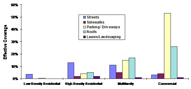
The costs of providing many public services (including roads, street lighting, utilities, emergency services, school transportation) increase with more dispersed development because distribution costs increase (more infrastructure and travel is needed to provide a given level of service), as indicated in Figure 2. These estimates often understate total impacts since most studies only consider a portion of total costs (most either consider capital costs or operating costs, but few include all public service costs). Sprawl often increases public service costs by hundreds of dollars annually per capita (Litman 2004b; Nelson, et al. 2008). One study (Burchell and Mukherji, 2003; Newport Partners 2008) found that sprawl increases in local road lane-miles 10%, annual public service costs about 10%, and housing costs about 8% ($13 000 per dwelling unit).
Figure 2 Residential Service Costs (Frank 1989, p. 40)

This illustrates increased capital costs for lower density, non-contiguous development. Higher density, clustered, infill development can provide savings worth hundreds of dollars annually compared with sprawl.
Community Livability and Social Impacts
Community Livability refers to local social and environmental conditions as they affect residents and visitors. Community cohesion (also called social capital) refers to the value of social networks within a community (Forkenbrock and Weisbrod, 2001, pp. 97-106; Alexander, Tomalty and Anielski 2004). These can provide significant value, increasing property values, reducing problems such as crime and increasing residents’ quality of life.
Transport activities and roadway design can significantly affect community livability and cohesion. Automobile-oriented land use patterns can reduce community livability and cohesion by increasing vehicle traffic impacts through neighborhoods, reduced opportunities for neighborhood interaction, dispersion of common destinations beyond convenient walking and cycling distance, degradation of walk and cycle conditions, decline of neighborhood shops, loss of public spaces suitable for casual social exchange, and increased fear of crime on city streets that are devoid of pedestrian traffic. Sprawl is associated with reduced housing diversity, increased housing costs, social alienation, reduced social interaction, and exacerbated urban problems (Isin and Tomalty 1993).
Housing Affordability
Sprawl has mixed impacts on housing Affordability. Critics argue that more compact development reduces housing affordability by limiting land supply (QuantEcon 2002), but these can be offset by reduced land requirements per unit, and reduced parking and utility costs (Litman, 2004a). Several studies indicate that when all factors are considered, Smart Growth does not reduce housing affordability (Nelson et al, 2002; Wassmer and Baass, 2005).
TDM strategies such as Location Efficient Development and Parking Management can reduce household costs in several ways, by reducing transportation and residential parking facility costs. Similarly, although Smart Growth Fiscal Reforms increase costs for lower-density, dispersed development, they reduce costs for clustered, infill development, increasing affordability for the types of housing that low-income households often choose.
Safety and Health
Land use patterns can influence Traffic Safety and Health. Although land use density tends to increase crash frequency per vehicle-mile (due to increased traffic density, which is why crash rates and insurance premiums tend to be higher in cities than in suburban or rural areas), it tends to reduce per capita vehicle travel and traffic speeds, which reduces crash severity. Per capita traffic fatalities and disabilities tend to increase with sprawl (Ewing and Hamidi 2014). Sprawl tends to reduce walking and cycling activity, and therefore physical fitness (Ewing, Schieber and Zegeer 2003; AJPH 2003). All told, city residents are much safer, even taking into account other risks that increase with urban living, such as pedestrian traffic injuries and homicide (Lucy 2002).
Environmental Impacts
Roads and parking facilities impose a variety of environmental costs (Brady and Richardson 2017; Forman, et al, 2003; Noonan 1996). Biologically active lands such as wetlands, forests, farms, and parks (collectively called greenspace) provide external benefits, including wildlife habitat, improved air and water quality, biological diversity, and social benefits of agricultural production (Quammen 1996). Pavement reduces these services, increases the intensity of stormwater runoff and flooding, and increases water pollution concentration. Paved surfaces have a “heat island” effect, which refers to higher local temperatures due to increased solar gain from dark colored roads, parking lots and building roofs (Stutz 1995, p. 391). These higher temperatures increase energy demand, smog and human discomfort.
Per capita transportation energy consumption and pollution emissions tend to decline with increased land use density and accessibility that reduces per capita vehicle travel (Mehaffy, Cowan and Urge-Vorsatz 2009).
Cultural and Aesthetic Impacts
Transportation facilities and sprawl sometimes threaten unique cultural resources, such as historic buildings, sacred land areas, neighborhood parks, older neighborhoods and towns, and traditional building styles. By reducing per capita land requirements and providing greater design flexibility, TDM and Smart Growth can avoid or reduce these impacts, allowing cultural preservation. Smart Growth and TDM also support urban redevelopment, which helps preserve existing towns and cities, and urban neighborhoods.
Roads and traffic also reduce natural environmental beauty and cause urban blight (Forman, et al, 2003; Nozzi, 2003). Automobile oriented development is inherently ugly because retail businesses must “shout” at passing motorists with raucous signs, because so much of the land must be used for automobile parking, and because the settlement pattern has no clear form. The value of attractive landscapes is indicated by their importance in attracting tourism and increasing adjacent property values, which undoubtedly worth many billions of dollars.
Equity Impacts
Some Equity implications of land use impacts are described below. These various impacts and perspectives should be identified in transportation and land use planning.
Horizontal Equity
Sprawl can cause horizontal inequity by increasing external costs. Urban neighborhood residents enjoy few of the benefits of sprawl but bear a share of costs, including increased public service costs, traffic impacts on neighborhoods, loss of greenspace and other types of environmental degradation. Motorists benefit from increased road and parking capacity, while pedestrians and cyclists bear many of the financial costs, and non-market costs such as pollution exposure and accident risk.
Vertical Equity With Respect to Income
Wider roads, increased parking and sprawl benefit lower income motorists by providing relatively high levels of mobility and increased housing affordability. However, the poor also bear many of the increased costs associated with sprawl, including increased vehicle costs and raising taxes and utility costs compared with more resource efficient development. Low-income people who can’t afford a car or cannot drive are much worse off because they cannot access suburban and exurban destinations, including many education, employment and social opportunities. Transportation and housing affordability are important issue from this perspective, and strategies such as Location Efficient Development can provide affordability benefits can improve equity.
Vertical Equity With Respect to Need and Ability
Sprawl land use patterns, with dispersed destinations, wide roads, heavy traffic, little consideration for walking conditions, reduces walking and transit Accessibility, making people who cannot drive due to physical, economic or social constraints much worse off (Ewing and Hamidi 2014).
Best Practices
Below are suggestions for improved evaluation of transportation land use impacts.
· Land use impacts should be considered in transportation planning, including direct impacts from land devoted to transportation facilities, and indirect impacts that result if transportation decisions affect land development patterns.
· Communities should establish strategic land use objectives related to accessibility, preservation of environmental and cultural resources, neighborhood preservation, urban redevelopment, walkability and aesthetics. Transportation decisions should reflect and support these objectives
· Transportation planning should recognize the full economic and environmental costs of paving land for roads and parking facilities, including the opportunity cost of reducing the amount of land available for other productive purposes, increased stormwater management costs, heat island effects, aesthetic degradation and barrier to pedestrian travel. Conversely, transportation and land use management strategies that reduce the land paved for transportation facilities should be valued.
· Land use impacts, and policies to reduce automobile travel and the amount of land required for roads and parking facilities, should be considered in suburban and rural, as well as urban areas.
· Develop integrated transportation/land use Models for evaluating planning decisions.
· In general, transportation and land use policies should favor medium-density, Clustered, mixed-use development patterns with human-scale, connected road networks, and discourage automobile dependent, sprawl development.
· Transportation and Parking Management strategies should be used as much as possible to minimize the amount of land devoted to parking in urban and suburban areas.
· The additional public costs associated with urban sprawl should be recognized in transportation decision-making and incorporated into user charges (Smart Growth Fiscal Reform).
· Land use management and transportation management policies should be integrated and complementary.
Conclusions
This chapter describes how transportation decisions can affect the following land use factors:
· Impervious surface coverage.
· Development location (infill or urban fringe).
· Development clustering and density.
· Land use mix.
· Accessibility.
· Roadway scale and design.
· Preservation of specific cultural and environmental resources.
· Travel options (particularly for non-drivers).
In general, transportation policies and programs that increase vehicle ownership and use tend to stimulate sprawl, while TDM strategies that reduce vehicle ownership and use tend to reduce sprawl. Sprawl, in turn, tends to increase the amount of travel needed to access activities and reduces transportation options. The result is often a self-reinforcing cycle of increased automobile use, more sprawl, and increased automobile dependency. Table 5 lists costs that tend to increase with sprawl and automobile dependency.
Table 5 Costs of Sprawl and Automobile Dependency
|
Economic |
Social |
Environmental |
|
Reduced accessibility and higher transportation costs.
Increased land devoted to roads and parking facilities.
Increased costs to provide public services.
Reduced regional business activity and employment.
Reduced economies of agglomeration.
Reduced economies of scale in transit and other alternative modes.
Threats to environmentally sensitive businesses (e.g. farming and resorts). |
Reduced accessibility for people who are transport disadvantaged.
Reduced housing options. Increased external transportation costs (crash risk, pollution, etc.).
Degraded public realm.
Reduced neighborhood interaction and community cohesion.
Reduced opportunities to preserve cultural resources.
Reduced exercise by walking and cycling. |
Increased impervious surface.
Reduced greenspace and habitat. Increased energy consumption and pollution emissions.
Aesthetic degradation.
Increased water pollution.
Increased “heat island” effects. |
This table summarizes various costs of sprawl, and costs that can be reduced by Smart Growth.
These land use impacts appear to be comparable in magnitude to other transportation costs and benefits: sprawl tends to increase transportation, public service and environmental costs by hundreds of dollars a year per capita. Transportation planning decisions that stimulate automobile ownership and use, and encourage sprawled land use can be considered to cause these incremental costs. Conventional transport planning tends to overlook these impacts because they are indirect and dispersed. These omissions favor more automobile oriented policies and investments, and undervalue TDM and Smart Growth alternatives.
Sprawl and automobile dependency can provide benefits. Low-density, urban fringe development increases mobility for motorists, reducing per-mile vehicle operating costs, and reduces land costs, allowing households to avoid more private greenspace and quiet. From individual consumers’ perspective, these benefits are often significant. However, such benefits are mostly internal, (that is, the benefits are to the people who own or use the land), which is to be expected since rational consumers tend to internalize benefits and externalize costs (Litman, 2006). Much of the perceived benefits are economic transfers: some consumers benefit while others are made worse off. For example, as households move to the urban fringe to enjoy privacy and quiet, they spoil these amenities for other residents. There appears to be little justification for society to subsidize or favor automobile travel or lower-density development over transportation and land use alternatives.
Current market distortions, which underprice automobile travel and dispersed development, result in more sprawl than is economically optimal, that is, more than what consumers would choose in an efficient market. Various planning and market reforms can help correct these distortions, leading to more economically efficient and equitable land use patterns. These reforms are generally considered Smart Growth and TDM strategies. Smart Growth can be considered the land use component of TDM, and TDM can be considered the transportation component of Smart Growth.
Smart Growth can increase some costs associated with increased land use density and mix, such as increased traffic and parking congestion, but these problems are caused by motor vehicle density, not population density. To the degree that TDM and Smart Growth programs reduce per capita motor vehicle ownership and use they reduce problems associated with density, allowing more Livable communities with higher densities than can occur in a more automobile dependent community.
This analysis does not suggest that sprawl is inherently “bad,” or that land use development and automobile travel should be prohibited. Rather, it indicates that sprawl imposes various economic, social and environmental costs which should be considered when evaluating transportation policies and programs. Ignoring these impacts results in more sprawl and automobile dependency than is economically and socially optimal.
|
A wealthy and foolish cheapskate had an economy ticket to fly from Los Angeles to New York. On entering the aircraft he sat down in a first class seat, hoping that he would be able to stay. The flight attendant asked politely to see his ticket stub. He ignored her, pretending to be engrossed in a magazine. The attendant was persistent. He finally showed her the ticket. She politely asked him to move back to his assigned seat. The passenger continued to ignore her, argue and delay in order to stay in the more comfortable seat.
Finally, the captain heard the commotion and came back from the cockpit. The attendant explained the situation. The captain bent over the unruly passenger and whispered a few words in his ear. The passenger gave the captain a shocked look, and quickly moved to his assigned seat in coach.
The attendant was amazed and ask the captain how he managed to convince the passenger to be cooperative so quickly and easily. The captain explained, “I told him that these seats are going to Alaska, and that he needs to move to the seats in back if he wants to go to New York.” |
References and Resources for More Information
Abley (2009), Commercial Activities In Auckland: Why A Centres Plus Approach Is Best – A Transportation Perspective, Auckland Regional Council (www.abley.com).
AJPH (2003), “Built Environment and Health,” American Journal of Public Health (www.ajph.org), Vol. 93, No. 9, September. Many of these articles are available at Active Living By Design (www.activelivingbydesign.com).
Alain Bertaud Website (http://alain-bertaud.com) includes information on urban models.
Don Alexander, Ray Tomalty and Mark Anielski (2004), BC Sprawl Report 2004-Economic Vitality and Livable Communities, Smart Growth BC (www.smartgrowth.bc.ca).
Chester Arnold and James Gibbons (1996), “Impervious Surface Coverage: The Emergence of a Key Environmental Indicator,” American Planning Association Journal, Vol. 62, No. 2, Spring, pp. 243-258. Also see http://nemo.uconn.edu/tools/impervious_surfaces/literature.htm.
ASSET (www.asset-eu.org) is a European Union project to develop practical tools for balancing the protection of environmentally sensitive areas with the provision of efficient transport systems.
Nathaniel Baum-Snow (2007), “Did Highways Cause Suburbanization?,” Quarterly Journal of Economics, Vol. 122, No. 2, pp. 775-805; at www.econ.brown.edu/fac/Nathaniel_Baum-Snow/hwy-sub.pdf. For more discussion of this issue see “Reply to Cox, Gordon, and Redfearn’s Comment on “Did Highways Cause Suburbanization?,” Econ Journal Watch, Volume 5, Number 1, January 2008, pp 46-50; at www.econjournalwatch.org/pdf/Baum-SnowReplyJanuary2008.pdf.
E. Brabec (1992), The Value of Preserving Open Land, Technical Information Series Vol. 1, No. 2, Scenic America (www.scenic.org).
Steven P. Brady and Jonathan L. Richardson (2017), “Road Ecology: Shifting Gears Toward Evolutionary Perspectives,” Frontiers in Ecology and the Environment (DOI: 10.1002/fee.1458).
Eric Christian Bruun (2014), Better Public Transit Systems: Analyzing Investments and Performance, Earthscan (www.routledge.com/sustainability).
Robert Burchell, et al (1998), The Costs of Sprawl – Revisited, TCRP Report 39, Transportation Research Board (www.trb.org); available online (http://gulliver.trb.org/publications/tcrp/tcrp_rpt_39-a.pdf).
Robert W. Burchell and Sahan Mukherji (2003), “Conventional Development Versus Managed Growth: The Costs of Sprawl,” American Journal of Public Health, Vol. 93, No. 9 (www.ajph.org), Sept. 2003, pp. 1534-1540; at www.minority.unc.edu/sph/minconf/2004/materials/burchell.and.mukherji.pdf.
Robert Burchell, Anthony Downs, Barbara McCann and Sahan Mukherji (2005), Sprawl Costs: Economic Impacts of Unchecked Development, Island Press (www.islandpress.org).
Julie Campoli and Alex MacLean (2002), Visualizing Density: A Catalog Illustrating the Density of Residential Neighborhoods, Lincoln Institute of Land Policy (www.lincolninst.edu).
CARB (2010 and 2011), Impacts of Transportation and Land Use-Related Policies, California Air Resources Board (http://arb.ca.gov/cc/sb375/policies/policies.htm).
Center for Watershed Protection (www.cwp.org) provides information on ways to protection watersheds.
Mark Delucchi (1998), “Motor Vehicle Infrastructure and Services Provided by the Public Sector,” Annualized Social Cost of Motor-Vehicle Use in the U.S., 1990-1991, Vol. 7, Institute of Transportation Studies (www.its.ucdavis.edu/research/publications/publication-detail/?pub_id=41), 1996, UCD-ITS-RR-96-3 (7).
Mark Eppli and Charles C. Tu (2000), Valuing the New Urbanism; The Impact of New Urbanism on Prices of Single-Family Homes, Urban Land Institute (www.uli.org).
Reid Ewing, Richard A. Schieber, Charles V. Zegeer (2003), “Urban Sprawl As A Risk Factor In Motor Vehicle Occupant And Pedestrian Fatalities,” American Journal of Public Health, Vol. 93, No. 9 (www.ajph.org), September, pp. 1541-1545; at www.ncbi.nlm.nih.gov/pmc/articles/PMC1448007.
Reid Ewing and Shima Hamidi (2014), Measuring Urban Sprawl and Validating Sprawl Measures, Metropolitan Research Center at the University of Utah for the National Cancer Institute, the Brookings Institution and Smart Growth America (www.smartgrowthamerica.org); at www.smartgrowthamerica.org/documents/measuring-sprawl-2014.pdf.
David Forkenbrock and Glen Weisbrod (2001), Guidebook for Assessing the Social and Economic Effects of Transportation Projects, NCHRP Report 456, Transportation Research Board (www.trb.org).
David Forkenbrock, Sondip K. Mathur and Lisa A. Schweitzer (2001), Transportation Investment Policy and Urban Land Use Patterns, University of Iowa Public Policy Center (www.uiowa.edu).
Richard T.T. Forman, et al (2003), Road Ecology: Science and Solutions, Island Press (www.islandpress.com).
James Frank (1989), The Costs of Alternative Development Patterns, Urban Land Institute (www.udi.org).
George Galster, et al (2001), “Wrestling Sprawl to the Ground: Defining and Measuring an Elusive Concept,” Housing Policy Debate, Vol. 12, Issue 4, Fannie Mae Foundation (www.fanniemaefoundation.org/programs/hpd/pdf/HPD_1204_galster.pdf), pp. 681-717.
Edward L. Glaeser (1998), “Are Cities Dying?,” Journal of Economic Perspectives, Vol. 12, No. 2, Spring 1998, pp. 139-160.
Edward Glaeser and Matthew Kahn (2003), Sprawl and Smart Growth, Chapter in the Handbook of Urban and Regional Economics, Center for Operations Research and Econometrics (www.core.ucl.ac.be:16080/staff/thisseHandbook/Sprawl%20and%20Urban%20Growth_PPR.pdf).
Peter Gordon and Harry Richardson (1997), “Are Compact Cities a Desirable Planning Goal?,” Journal of the American Planning Association, Vol. 63, No. 1, Winter 1997.
Peter Gordon and Harry W. Richardson (2000), Critiquing Sprawl’s Critics, Policy Analysis No 365, Cato Institute (www.cato.org).
Zhan Guo, et al. (2011), The Intersection of Urban Form and Mileage Fees: Findings from the Oregon Road User Fee Pilot Program, Report 10-04, Mineta Transportation Institute (http://transweb.sjsu.edu); at http://transweb.sjsu.edu/PDFs/research/2909_10-04.pdf.
Timothy F. Harris and Yannis M. Ioannides (2000), Productivity and Metropolitan Density, Dept. of Economics, Tufts University (http://ase.tufts.edu/econ/papers/200016.pdf).
John Holtzclaw (1994), Using Residential Patterns and Transit to Decrease Auto Dependence and Costs, National Resources Defense Council (www.nrdc.org).
ICMA (2014), Why Smart Growth: A Primer, International City/County Management Association and the Smart Growth Network (www.smartgrowth.org); at www.epa.gov/smartgrowth/pdf/WhySmartGrowth_bk.pdf.
Gregory K. Ingram and Yu-Hung Hong (2009), Evaluating Smart Growth: State and Local Policy Outcomes, Lincoln Institute for Land Policy (www.lincolninst.edu); at www.lincolninst.edu/pubs/PubDetail.aspx?pubid=1572.
Engin Isin and Ray Tomalty (1993), Resettling Cities: Canadian Residential Intensification Initiatives, Canadian Mortgage and Housing Corporation (www.cmhc-schl.gc.ca); at http://dsp-psd.pwgsc.gc.ca/Collection/NH18-23-20E.pdf.
Ben Janke, John S. Gulliver and Bruce N. Wilson (2011), Development of Techniques to Quantify Effective Impervious Cover, Center for Transportation Studies, University of Minnesota (www.cts.umn.edu); at www.cts.umn.edu/Publications/ResearchReports/reportdetail.html?id=2058.
Eric Damian Kelly (1994), “The Transportation Land-Use Link,” Journal of Planning Literature, Vol. 9, No. 2, Nov. 1994, pp. 128-145.
Richard J. Kuzmyak and Richard H. Pratt (2003), Land Use and Site Design: Traveler Response to Transport System Changes, Chapter 15, Report 95, Transit Cooperative Research Program; Transportation Research Board (www.trb.org).
Douglass Lee (1999), The Efficient City: Impacts of Transportation on Urban Form, Volpe Transportation Center (www.volpe.dot.gov), presented at ACSP Annual Conference.
Michael Lewyn (2000), “Why Sprawl Is a Conservative Issue,” Bulletin of Science, Technology & Society, Vol. 20, No. 4, Sage Publications (www.sagepub.com), August 2000, pp. 295-315.
Michael Lewyn (2002), “Suburban Sprawl: Not Just An Environmental Issue,” Marquette Law Review, Vol. 84, No. 2, Marquette University (http://law.marquette.edu), Winter, 2002, pp. 301-382.
Jonathan Levine (2006), Zoned Out: Regulation, Markets, and Choices in Transportation and Metropolitan Land-Use, Resources for the Future (www.rff.org).
Kevin M. Leyden (2003), “Social Capital and the Built Environment: The Importance of Walkable Neighborhoods,” American Journal of Public Health, Vol. 93, No. 9 (www.ajph.org), Sept. 2003, pp. 1546-1551.
Todd Litman (2003), Evaluating Criticism of Smart Growth, Victoria Transport Policy Institute (www.vtpi.org); at www.vtpi.org/sgcritics.pdf.
Todd Litman (2004a), Transportation Land Valuation; Evaluating Policies and Practices that Affect the Amount of Land Devoted to Transportation Facilities, Victoria Transport Policy Institute (www.vtpi.org).
Todd Litman (2004b), Understanding Smart Growth Savings: What We Know About Public Infrastructure and Service Cost Savings, And How They are Misrepresented By Critics, Victoria Transport Policy Institute (www.vtpi.org); at www.vtpi.org/sg_save.pdf.
Todd Litman (2005), Evaluating Transportation Land Use Impacts, Victoria Transport Policy Institute (www.vtpi.org); at www.vtpi.org/landuse.pdf; originally published in World Transport Policy & Practice, Vol. 1, No. 4, pp. 9-16 (www.eco-logica.co.uk/worldtransport.html).
Todd Litman (2006), Transportation Cost and Benefit Analysis: Techniques, Estimates and Implications, Victoria Transport Policy Institute (www.vtpi.org/tca).
Todd Litman (2006), Community Cohesion As A Transport Planning Objective, Victoria Transport Policy Institute (www.vtpi.org/tca); at www.vtpi.org/cohesion.pdf.
Todd Litman (2007), Pavement Buster’s Guide: Why and How to Reduce the Amount of Land Paved for Roads and Parking Facilities, VTPI (www.vtpi.org); at www.vtpi.org/pavbust.pdf.
Todd Litman (2008), Land Use Impacts on Transport: How Land Use Factors Affect Travel Behavior, Victoria Transport Policy Institute (www.vtpi.org); at www.vtpi.org/landtravel.pdf.
Todd Litman (2009), Where We Want To Be: Household Location Preferences And Their Implications For Smart Growth, VTPI (www.vtpi.org); at www.vtpi.org/sgcp.pdf.
Todd Litman (2011), “Can Smart Growth Policies Conserve Energy and Reduce Emissions?” Portland State University’s Center for Real Estate Quarterly (www.pdx.edu/realestate/research_quarterly.html), Vol. 5, No. 2, Spring, pp. 21-30; at www.vtpi.org/REQJ.pdf. Also see, Critique of the National Association of Home Builders’ Research On Land Use Emission Reduction Impacts, Victoria Transport Policy Institute (www.vtpi.org); at www.vtpi.org/NHBAcritique.pdf.
Todd Litman (2011), “Why and How to Reduce the Amount of Land Paved for Roads and Parking Facilities,” Environmental Practice, Vol. 13, No. 1, March, pp. 38-46 (http://journals.cambridge.org/action/displayJournal?jid=ENP); at www.vtpi.org/EP_Pav.pdf.
Todd Litman (2014), Analysis of Public Policies That Unintentionally Encourage and Subsidize Urban Sprawl, commissioned by LSE Cities (www.lsecities.net), for the Global Commission on the Economy and Climate (www.newclimateeconomy.net); at http://bit.ly/1EvGtIN.
Todd Litman (2015), Understanding Smart Growth Savings, VTPI (www.vtpi.org); at www.vtpi.org/sg_save.pdf.
Todd Litman (2016), Affordable-Accessible Housing in a Dynamic City: Why and How to Support Development of More Affordable Housing in Accessible Locations, Victoria Transport Policy Institute (www.vtpi.org); at www.vtpi.org/aff_acc_hou.pdf.
Todd Litman (2017), Selling Smart Growth: Communicating The Direct Benefits of More Accessible, Multi-Modal Locations to Households, Businesses and Governments, Victoria Transport Policy Institute (www.vtpi.org); at www.vtpi.org/ssg.pdf.
Todd Litman (2017), “Determining Optimal Urban Expansion, Population and Vehicle Density, and Housing Types for Rapidly Growing Cities,” Transportation Research Procedia, for the 2015 World Conference on Transport Research; at www.vtpi.org/WCTR_OC.pdf.
William Lucy (2002), Danger in Exurbia: Outer Suburbs More Dangerous Than Cities, University of Virginia (www.virginia.edu), 2002; summarized in www.virginia.edu/topnews/releases2002/lucy-april-30-2002.html
William Lucy and David L. Phillips (2006), Tomorrow’s Cities, Tomorrow’s Suburbs, Planners Press (www.planning.org).
Christopher McCahill and Norman Garrick (2012), “Automobile Use And Land Consumption: Empirical Evidence From 12 Cities,” Urban Design International, Vol. 17, Autumn, pp. 221-227 (doi:10.1057/udi.2012.12); summarized in “Cars and Robust Cities Are Fundamentally Incompatible,” The Atlantic Cities, www.theatlanticcities.com/commute/2013/02/cars-and-robust-cities-are-fundamentally-incompatible/4651.
Barbara McCann (2000), Driven to Spend; The Impact of Sprawl on Household Transportation Expenses, STPP (www.transact.org).
Michael Mehaffy, Stuart Cowan and Diana Urge-Vorsatz (2009), Factors of Urban Morphology in Greenhouse Gas Emissions: A Research Overview, presented at the International Alliance of Research Universities Scientific Congress on Climate Change, 10 March 2009; at www.tectics.com/IARU.htm.
Terry Moore and Paul Throsnes (1994), The Transportation/Land Use Connection, American Planning Assoc., Planning Advisory Service, Report 448/449 (www.planning.org).
Montana Transportation and Land Use Toolkit (www.mdt.mt.gov/research/toolkit/default.shtml) provides best practices for better coordinating transportation and land use decisions.
Anne Vernez Moudon and Paul Mitchell Hess (2000), “Suburban Clusters: The Nucleation of Multifamily Housing in Suburban Areas in the Central Puget Sound,” American Planning Association Journal, Vol. 66, No. 3, Summer 2000, pp. 243-263.
Mark Muro and Robert Puentes (2004), Investing In A Better Future: A Review Of The Fiscal And Competitive Advantages Of Smarter Growth Development Patterns, Brookings Institute (www.brookings.edu).
NAR (2003), Creating Great Neighborhoods: Density in Your Community, The National Association of Realtors, the Local Government Commission and the U.S. Environmental Protection Agency (www.epa.gov/smartgrowth/pdf/density.pdf).
O’Neill, et al (1995), “Sustainability at Landscape and Regional Scales, Defining and Measuring Sustainability, United Nations University and World Bank; at www.scribd.com/doc/27051904/Defining-and-Measuring-Sustainability-The-Bio-Geophysical-Foundations.
Arthur C. Nelson, Rolf Pendall, Casy Dawkins and Gerrit Knaap (2002), The Link Between Growth Management and Housing Affordability: The Academic Evidence, Brookings Institution Center on Urban and Metropolitan Policy (www.brook.edu).
Arthur C. Nelson, et al. (2008), A Guide to Impacts Fees and Housing Affordability, Island Press (www.islandpress.org); at http://islandpress.org/ip/books/book/islandpress/G/bo8018008.html.
NEMO Project (http://nemo.uconn.edu) provides information on impervious surface economic and environmental impacts.
Peter Newman and Jeff Kenworthy (1999), Sustainability and Cities; Overcoming Automobile Dependence, Island Press (www.islandpress.org).
Newport Partners (2008), Impact Fees and Housing Affordability: A Guidebook for Practitioners, U.S. Department of Housing and Urban Development (www.huduser.gov); at www.huduser.gov/portal/publications/impactfees.pdf.
Henry Diamond Patrick Noonan (1996), Land Use in America: Report of the Sustainable Use of Land Project, Lincoln Institute (www.lincolninst.org).
Reed Noss (1995), Ecological Effects of Roads; or The Road To Destruction, Wildland CPR (www.wildrockies.org).
Dom Nozzi (2003), Road To Ruin: An Introduction To Sprawl And How To Cure It, Praeger (www.praeger.com).
NRDC (2000), Developments and Dollars: An Introduction to Fiscal Impact Analysis in Land Use Planning, Cities & Green Living, Natural Resources Defense Council (www.nrdc.org/cities/smartgrowth/dd/ddinx.asp).
OEP (2012), Evaluating The Fiscal Impacts Of Development, Part I - Final Report and User’s Manual, New Hampshire Office of Energy and Planning (www.nh.gov/oep); at www.costofsprawl.org/Evaluating-Fiscal-Impacts-of-Development-Part-I.pdf.
Planners Energy and Climate Database (www.planning.org/research/energy/database/index.htm) provides examples of communities that have taken steps to integrate energy and climate change issues into planning and relevant documents to help planners understand and address energy and climate change.
David Quammen (1996), The Song of the Dodo, Touchstone (NY).
QuantEcon (2002), Smart Growth and Its Effects on Housing Markets: The New Segregation, National Center for Public Policy Research (www.nationalcenter.org).
SFLCV (2003), This View of Density Calculator, San Francisco League of Conservation Voters (www.sflcv.org/density). This website illustrates various land use patterns, predicts their effects on travel behavior, and discusses various issues related to New Urbanist development.
Sprawl and Health (http://cascadiascorecard.typepad.com/sprawl_and_health) is an ongoing literature review by researchers at Northwest Environment Watch on the intersection of sprawl and health.
Jeffery J. Smith and Thomas A. Gihring (2005), Financing Transit Systems Through Value Capture: An Annotated Bibliography (Previously titled: Does Public Transit Service Raise Nearby Property Values Enough To Pay For Itself Were The Value Captured?), Geonomy Society (www.progress.org/geonomy); at www.vtpi.org/smith.htm.
STPP (1999), Why Are the Roads So Congested? An Analysis of the Texas Transportation Institute's Data On Metropolitan Congestion, Surface Transportation Policy Project (www.transact.org).
Frederick Stutz (1995), “Environmental Impacts,” Geography of Urban Transportation, Susan Hanson, Ed., Guilford (New York).
TCRP (2012), Assessing and Comparing Environmental Performance of Major Transit Investments, Transit Cooperative Research Program (www.tcrponline.org); at http://onlinepubs.trb.org/onlinepubs/tcrp/tcrp_w55.pdf.
Toolbox for Regional Policy Analysis Website (www.fhwa.dot.gov/planning/toolbox/index.htm) by the US Federal Highway Administration, describes analytical methods for evaluating regional economic, social and environmental impacts of various transportation and land use policies.
TRANSPLUS Website (www.transplus.net), provides information on research on transport planning, land use and sustainability, sponsored by the European Commission.
Transport Geography on the Web (www.people.hofstra.edu/geotrans) is an Internet resource to promote access to transport geography information, including articles, maps, figures, and datatsets.
Transport Geography Research Group Website (www.abdn.ac.uk/tgrg) promotes the dissemination of information on transport geography among academics and practioners.
TRB (2009), Driving and the Built Environment: The Effects of Compact Development on Motorized Travel, Energy Use, and CO2 Emissions, Special Report 298, Transportation Research Board (www.trb.org); at http://onlinepubs.trb.org/Onlinepubs/sr/sr298prepub.pdf.
USEPA (1992), Cooling Our Communities, USEPA (www.epa.gov), GPO#055-000-00371-8.
USEPA (1999), Indicators of the Environmental Impacts of Transportation, Office of Policy and Planning, USEPA (www.itre.ncsu.edu/cte).
USEPA (2001), Improving Air Quality Through Land Use Activities - EPA Guidance, Office of Transportation and Air Quality, USEPA (www.epa.gov/otaq/stateresources/policy/pag_transp.htm).
USEPA (2004), Characteristics and Performance of Regional Transportation Systems, Smart Growth Program, US Environmental Protection Agency (www.epa.gov/smartgrowth/performance2004final.pdf).
USEPA (2013), Our Built and Natural Environments: A Technical Review of the Interactions Among Land Use, Transportation, and Environmental Quality, U.S. Environmental Protection Agency (www.epa.gov); at www.epa.gov/smartgrowth/pdf/b-and-n/b-and-n-EPA-231K13001.pdf.
USEPA (2014), Smart Growth and Economic Success: Strategies for Local Governments, U.S. Environmental Protection Agency (www.epa.gov); at www.epa.gov/smartgrowth/pdf/economicsuccess/sg-and-economic-success-for-governments.pdf.
USEPA, Smart Growth Policy Database, US Environmental Protection Agency (http://cfpub.epa.gov/sgpdb/browse.cfm) provides information on dozens of policies that encourage more efficient transportation and land use patterns, with hundreds of case studies.
Robert W. Wassmer and Michelle C. Baass (2005), Does a More Centralized Urban Form Raise Housing Prices, APPAM “Suburbanization and its Discontents” conference; Journal of Policy Analysis and Management (forthcoming); California State University Sacramento (www.csus.edu/indiv/w/wassmerr/WassmerBaassSprawlHousing.pdf), 2005.
This Encyclopedia is produced by the Victoria Transport Policy Institute to help improve understanding of Transportation Demand Management. It is an ongoing project. Please send us your comments and suggestions for improvement.
Victoria Transport Policy Institute
www.vtpi.org info@vtpi.org
1250 Rudlin Street, Victoria, BC, V8V 3R7, CANADA
Phone & Fax 250-360-1560
#104